Jhingergācha geodata
Jhingergācha (Khulna) is a populated place; located in Bangladesh in Asia/Dhaka (GMT+6) time zone. With population of 41,957 people, there are 74 cities with bigger population in this country. Compared to other cities in Bangladesh, 68.4% of cities are located further ↑North; 82.9% of cities are located further →East and 50.4% of cities have lower elevation than Jhingergācha. Note1
Administrative division(s):
- Level 1: Khulna
- Level 2: Jessore
- Level 3: Jhikargachha Upazila
- Level 4: Jhikargachha


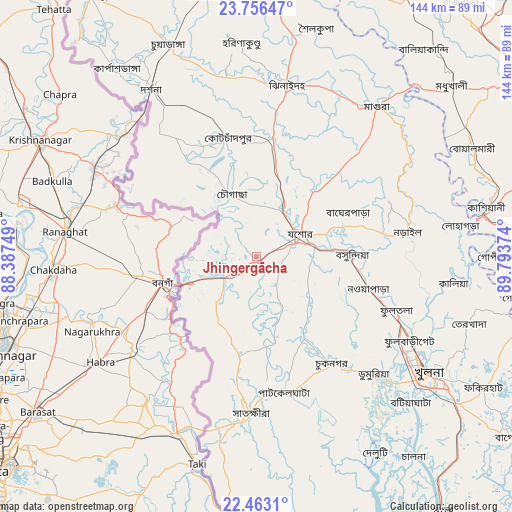
Jhingergācha GPS coordinates[2]
23° 6' 40.824" North, 89° 5' 26.196" East
| Map corner | latitude | longitude |
|---|---|---|
| Upper-left | 23.75647°, | 88.38749° |
| Center: | 23.11134°, | 89.09061° |
| Lower-right: | 22.4631°, | 89.79374° |
| Map W x H: | 143.8×143.8 km | = 89.4×89.4mi |
| max Lat: | 26.33338° ⇑68.4% North |
| Jhingergācha: | 23.11134° |
| min Lat: | ⇓31.6% South 20.85829° |
| min Long | Jhingergācha | max Long |
| 88.15638° | 89.09061° | 92.29773° |
| W 17.1%⇐ | ⇒82.9% E |
Elevation
Elevation of Jhingergācha is 15 m = 49 ft, and this is 2.9 m = 10 ft below average elevation for this country.
| Max E: |
79 m = 259 ft | 49.6% |
| Avg. | 17.9 m = 59 ft | |
| Jhingergācha | 15 m = 49 ft | |
Min E: |
2 m = 7 ft | 50.4% |
See also: Jhingergācha elevation on elevation.city.
Geographical zone
Jhingergācha is located in North Torrid zone (between Equator and Tropic of Cancer). Distance of this Northern Tropic circle is 36.2 km =22.5 mi to North.| Distance of | km | miles | from Jhingergācha |
|---|---|---|---|
| North Pole | 7437.3 | 4621.3 | to North |
| Arctic Circle | 4831.4 | 3002.1 | to North |
| Tropic Cancer | 36.2 | 22.5 | to North |
| Equator | 2569.7 | 1596.7 | to South |


Nearby cities:
15 places around Jhingergācha: (largest is in red/bold)
• Bagerhat
87.8 km =54.6 mi,  125°
125°
• Bhātpāra Abhaynagar
37.3 km =23.2 mi,  106°
106°
• Jessore
14.2 km =8.8 mi,  62°
62°
• Kesabpur
26.3 km =16.3 mi,  149°
149°
• Khulna
59 km =36.7 mi,  124°
124°
• Kushtia
88.1 km =54.7 mi,  1°
1°
• Kālia
55.8 km =34.7 mi,  97°
97°
• Kālīganj
33.5 km =20.8 mi,  8°
8°
• Magura
53.4 km =33.2 mi,  38°
38°
• Narail
41.6 km =25.8 mi,  83°
83°
• Nowlamary
63.4 km =39.4 mi,  350°
350°
• Phultala
61.5 km =38.2 mi,  135°
135°
• Sātkhira
44.9 km =27.9 mi,  182°
182°
• Tungipāra
86.4 km =53.7 mi, 105°
• Ujalpur
90.7 km =56.4 mi,  328°
328°
Sources, notices
• [Note1] Compared only with cities in Bangladesh existing in our database
• [Src1] Map data: © OpenStreetMap contributors (CC-BY-SA)
• [Src2] Other city data from geonames.org with taken over terms of usage.
• [Src3] Geographical zone / Annual Mean Temperature by Robert A. Rohde @ Wikipedia
