Tungipāra geodata
Tungipāra (Dhaka) is a populated place; located in Bangladesh in Asia/Dhaka (GMT+6) time zone. With population of 62,210 people, there are 52 cities with bigger population in this country. Compared to other cities in Bangladesh, 77.8% of cities are located further ↑North; 58.1% of cities are located further →East and 92.3% of cities have higher elevation than Tungipāra. Note1


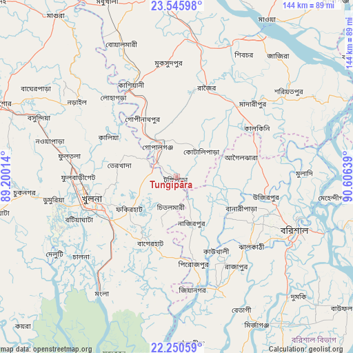
Tungipāra GPS coordinates[2]
22° 53' 59.388" North, 89° 54' 11.736" East
| Map corner | latitude | longitude |
|---|---|---|
| Upper-left | 23.54598°, | 89.20014° |
| Center: | 22.89983°, | 89.90326° |
| Lower-right: | 22.25059°, | 90.60639° |
| Map W x H: | 144×144 km | = 89.5×89.5mi |
| max Lat: | 26.33338° ⇑77.8% North |
| Tungipāra: | 22.89983° |
| min Lat: | ⇓22.2% South 20.85829° |
| min Long | Tungipāra | max Long |
| 88.15638° | 89.90326° | 92.29773° |
| W 41.9%⇐ | ⇒58.1% E |
Elevation
Elevation of Tungipāra is 8 m = 26 ft, and this is 9.9 m = 32 ft below average elevation for this country.
| Max E: |
79 m = 259 ft | 92.3% |
| Avg. | 17.9 m = 59 ft | |
| Tungipāra | 8 m = 26 ft | |
Min E: |
2 m = 7 ft | 7.7% |
See also: Tungipāra elevation on elevation.city.
Geographical zone
Tungipāra is located in North Torrid zone (between Equator and Tropic of Cancer). Distance of this Northern Tropic circle is 59.7 km =37.1 mi to North.| Distance of | km | miles | from Tungipāra |
|---|---|---|---|
| North Pole | 7460.8 | 4635.9 | to North |
| Arctic Circle | 4855 | 3016.8 | to North |
| Tropic Cancer | 59.7 | 37.1 | to North |
| Equator | 2546.2 | 1582.1 | to South |


Nearby cities:
15 places around Tungipāra: (largest is in red/bold)
• Bagerhat
29.4 km =18.3 mi,  203°
203°
• Barisāl
52.5 km =32.6 mi,  114°
114°
• Bhāndāria
48.5 km =30.1 mi,  160°
160°
• Bhātpāra Abhaynagar
49.2 km =30.6 mi,  285°
285°
• Char Bhadrāsan
56.3 km =35 mi,  36°
36°
• Gaurnadi
33.8 km =21 mi,  75°
75°
• Khulna
36.1 km =22.4 mi,  253°
253°
• Kālia
32.1 km =19.9 mi,  299°
299°
• Morrelgonj
49.6 km =30.8 mi,  185°
185°
• Mādārīpur
43.5 km =27 mi,  46°
46°
• Narail
50.5 km =31.4 mi, 304°
• Nālchiti
47.8 km =29.7 mi,  127°
127°
• Phultala
45 km =28 mi,  243°
243°
• Pirojpur
36.4 km =22.6 mi,  168°
168°
• Pālang
57.9 km =36 mi, 52°
Sources, notices
• [Note1] Compared only with cities in Bangladesh existing in our database
• [Src1] Map data: © OpenStreetMap contributors (CC-BY-SA)
• [Src2] Other city data from geonames.org with taken over terms of usage.
• [Src3] Geographical zone / Annual Mean Temperature by Robert A. Rohde @ Wikipedia
