Manikchari geodata
Manikchari (Chittagong) is a populated place; located in Bangladesh in Asia/Dhaka (GMT+6) time zone. With population of 24,813 people, there are 102 cities with bigger population in this country. Compared to other cities in Bangladesh, 78.6% of cities are located further ↑North; 93.2% of cities are located further ←West and 90.6% of cities have lower elevation than Manikchari. Note1
Administrative division(s):
- Level 1: Chittagong
- Level 2: Khagrachhari
- Level 3: Manikchhari
- Level 4: Manikchhari


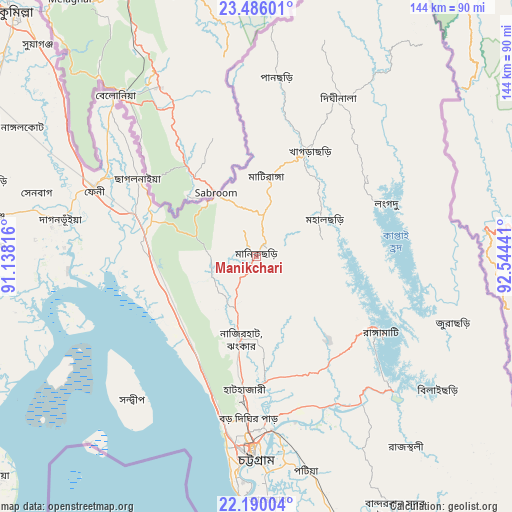
Manikchari GPS coordinates[2]
22° 50' 22.452" North, 91° 50' 28.608" East
| Map corner | latitude | longitude |
|---|---|---|
| Upper-left | 23.48601°, | 91.13816° |
| Center: | 22.83957°, | 91.84128° |
| Lower-right: | 22.19004°, | 92.54441° |
| Map W x H: | 144.1×144.1 km | = 89.5×89.5mi |
| max Lat: | 26.33338° ⇑78.6% North |
| Manikchari: | 22.83957° |
| min Lat: | ⇓21.4% South 20.85829° |
| min Long | Manikchari | max Long |
| 88.15638° | 91.84128° | 92.29773° |
| W 93.2%⇐ | ⇒6.8% E |
Elevation
Elevation of Manikchari is 33 m = 108 ft, and this is 15.1 m = 50 ft above average elevation for this country.
| Max E: |
79 m = 259 ft | 9.4% |
| Manikchari | 33 m 108 ft | |
| Avg. | 17.9 m = 59 ft | |
Min E: |
2 m = 7 ft | 90.6% |
See also: Bangladesh elevation on elevation.city.
Geographical zone
Manikchari is located in North Torrid zone (between Equator and Tropic of Cancer). Distance of this Northern Tropic circle is 66.4 km =41.3 mi to North.| Distance of | km | miles | from Manikchari |
|---|---|---|---|
| North Pole | 7467.5 | 4640.1 | to North |
| Arctic Circle | 4861.7 | 3020.9 | to North |
| Tropic Cancer | 66.4 | 41.3 | to North |
| Equator | 2539.5 | 1578 | to South |


Nearby cities:
15 places around Manikchari: (largest is in red/bold)
• Bibir Hat
18.1 km =11.2 mi,  196°
196°
• Bāndarban
81.5 km =50.6 mi,  151°
151°
• Chhāgalnāiya
39.6 km =24.6 mi,  301°
301°
• Chittagong
55.7 km =34.6 mi,  181°
181°
• Comilla
96.4 km =59.9 mi,  315°
315°
• Feni
49.5 km =30.8 mi,  293°
293°
• Hājīganj
110.8 km =68.8 mi, 294°
• Khagrachhari
32.6 km =20.3 mi,  23°
23°
• Lakshmīpur
104.2 km =64.7 mi,  276°
276°
• Lākshām
86.1 km =53.5 mi, 301°
• Patiya
62.1 km =38.6 mi,  166°
166°
• Raojān
34.8 km =21.6 mi, 166°
• Rāmganj
105.6 km =65.6 mi, 285°
• Sandwīp
53.7 km =33.4 mi,  227°
227°
• Sātkania
87.5 km =54.4 mi, 165°
Sources, notices
• [Note1] Compared only with cities in Bangladesh existing in our database
• [Src1] Map data: © OpenStreetMap contributors (CC-BY-SA)
• [Src2] Other city data from geonames.org with taken over terms of usage.
• [Src3] Geographical zone / Annual Mean Temperature by Robert A. Rohde @ Wikipedia
