Sātkania geodata
Sātkania (Chittagong) is a populated place; located in Bangladesh in Asia/Dhaka (GMT+6) time zone. With population of 52,005 people, there are 60 cities with bigger population in this country. Compared to other cities in Bangladesh, 98.3% of cities are located further ↑North; 98.3% of cities are located further ←West and 65% of cities have higher elevation than Sātkania. Note1
Administrative division(s):
- Level 1: Chittagong
- Level 2: Chittagong
- Level 3: Satkania
- Level 4: Satkania


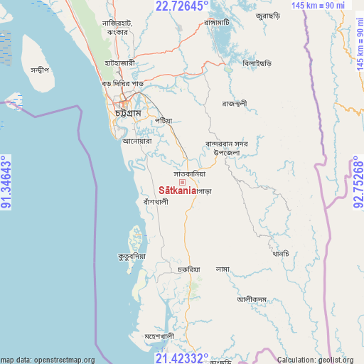
Sātkania GPS coordinates[2]
22° 4' 35.004" North, 92° 2' 58.38" East
| Map corner | latitude | longitude |
|---|---|---|
| Upper-left | 22.72645°, | 91.34643° |
| Center: | 22.07639°, | 92.04955° |
| Lower-right: | 21.42332°, | 92.75268° |
| Map W x H: | 144.9×144.9 km | = 90×90mi |
| max Lat: | 26.33338° ⇑98.3% North |
| Sātkania: | 22.07639° |
| min Lat: | ⇓1.7% South 20.85829° |
| min Long | Sātkania | max Long |
| 88.15638° | 92.04955° | 92.29773° |
| W 98.3%⇐ | ⇒1.7% E |
Elevation
Elevation of Sātkania is 13 m = 43 ft, and this is 4.9 m = 16 ft below average elevation for this country.
| Max E: |
79 m = 259 ft | 65% |
| Avg. | 17.9 m = 59 ft | |
| Sātkania | 13 m = 43 ft | |
Min E: |
2 m = 7 ft | 35% |
See also: Sātkania elevation on elevation.city.
Geographical zone
Sātkania is located in North Torrid zone (between Equator and Tropic of Cancer). Distance of this Northern Tropic circle is 151.3 km =94 mi to North.| Distance of | km | miles | from Sātkania |
|---|---|---|---|
| North Pole | 7552.4 | 4692.8 | to North |
| Arctic Circle | 4946.5 | 3073.6 | to North |
| Tropic Cancer | 151.3 | 94 | to North |
| Equator | 2454.7 | 1525.3 | to South |


Nearby cities:
15 places around Sātkania: (largest is in red/bold)
• Bibir Hat
72.6 km =45.1 mi,  338°
338°
• Burhānuddin
144.1 km =89.5 mi,  288°
288°
• Bāndarban
21.9 km =13.6 mi,  52°
52°
• Chhāgalnāiya
119.1 km =74 mi,  332°
332°
• Chittagong
36.8 km =22.9 mi,  322°
322°
• Cox’s Bāzār
70.9 km =44.1 mi,  183°
183°
• Feni
124 km =77.1 mi, 327°
• Khagrachhari
115 km =71.5 mi,  355°
355°
• Lālmohan
138.2 km =85.9 mi,  282°
282°
• Manikchari
87.5 km =54.4 mi,  345°
345°
• Patiya
25.4 km =15.8 mi, 343°
• Raojān
52.7 km =32.7 mi, 345°
• Sandwīp
78.2 km =48.6 mi,  308°
308°
• Teknāf
137.9 km =85.7 mi,  169°
169°
• Uttar Char Fasson
138.7 km =86.2 mi, 276°
Sources, notices
• [Note1] Compared only with cities in Bangladesh existing in our database
• [Src1] Map data: © OpenStreetMap contributors (CC-BY-SA)
• [Src2] Other city data from geonames.org with taken over terms of usage.
• [Src3] Geographical zone / Annual Mean Temperature by Robert A. Rohde @ Wikipedia
