Geer geodata
Geer (Wallonia) is a populated place; located in Belgium in Europe/Brussels (GMT+2) time zone. With population of 2,682 people, there are 518 cities with bigger population in this country. Compared to other cities in Belgium, 61.7% of cities are located further ↑North; 72.6% of cities are located further ←West and 71.3% of cities have lower elevation than Geer. Note1
Administrative division(s):
- Level 1: Wallonia
- Level 2: Province de Liège
- Level 3: Arrondissement de Waremme
- Level 4: Geer


Geer GPS coordinates[2]
50° 40' 11.64" North, 5° 10' 25.104" East
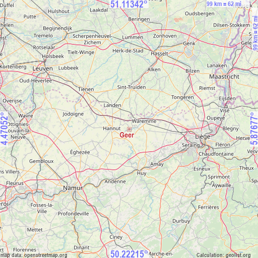
| Map corner | latitude | longitude |
|---|---|---|
| Upper-left | 51.11342°, | 4.47052° |
| Center: | 50.6699°, | 5.17364° |
| Lower-right: | 50.22215°, | 5.87677° |
| Map W x H: | 99.1×99.1 km | = 61.6×61.6mi |
| max Lat: | 51.46791° ⇑61.7% North |
| Geer: | 50.6699° |
| min Lat: | ⇓38.3% South 49.53771° |
| min Long | Geer | max Long |
| 2.59368° | 5.17364° | 6.25749° |
| W 72.6%⇐ | ⇒27.4% E |
Elevation
Elevation of Geer is 129 m = 423 ft, and this is 29.5 m = 97 ft above average elevation for this country.
| Max E: |
582 m = 1909 ft | 28.7% |
| Geer | 129 m 423 ft | |
| Avg. | 99.5 m = 326 ft | |
Min E: |
1 m = 3 ft | 71.3% |
See also: Belgium elevation on elevation.city.
Geographical zone
Geer is located in North temperate zone (between Tropic of Cancer and the Arctic Circle). Distance of this North polar circle is 1767.2 km =1098.1 mi to North.| Distance of | km | miles | from Geer |
|---|---|---|---|
| North Pole | 4373.1 | 2717.3 | to North |
| Arctic Circle | 1767.2 | 1098.1 | to North |
| Tropic Cancer | 3028 | 1881.5 | to South |
| Equator | 5634 | 3500.8 | to South |


Nearby cities:
15 places around Geer: (largest is in red/bold)
• Berloz
4.2 km =2.6 mi,  40°
40°
• Braives
6.5 km =4 mi,  206°
206°
• Burdinne
11.7 km =7.3 mi,  215°
215°
• Donceel
10.6 km =6.6 mi,  103°
103°
• Faimes
6.1 km =3.8 mi, 97°
• Gingelom
9.1 km =5.7 mi,  342°
342°
• Hannut
6.7 km =4.2 mi,  271°
271°
• Heers
13 km =8.1 mi, 44°
• Landen
11.2 km =7 mi,  324°
324°
• Lincent
10.7 km =6.6 mi,  295°
295°
• Remicourt
10.9 km =6.8 mi,  83°
83°
• Verlaine
12.3 km =7.6 mi,  124°
124°
• Villers-le-Bouillet
12 km =7.5 mi,  149°
149°
• Waremme
6.5 km =4 mi,  61°
61°
• Wasseiges
13 km =8.1 mi,  245°
245°
Sources, notices
• [Note1] Compared only with cities in Belgium existing in our database
• [Src1] Map data: © OpenStreetMap contributors (CC-BY-SA)
• [Src2] Other city data from geonames.org with taken over terms of usage.
• [Src3] Geographical zone / Annual Mean Temperature by Robert A. Rohde @ Wikipedia
