Berloz geodata
Berloz (Wallonia) is a populated place; located in Belgium in Europe/Brussels (GMT+2) time zone. With population of 2,770 people, there are 514 cities with bigger population in this country. Compared to other cities in Belgium, 59% of cities are located further ↑North; 73.5% of cities are located further ←West and 70% of cities have lower elevation than Berloz. Note1
Administrative division(s):
- Level 1: Wallonia
- Level 2: Province de Liège
- Level 3: Arrondissement de Waremme
- Level 4: Berloz


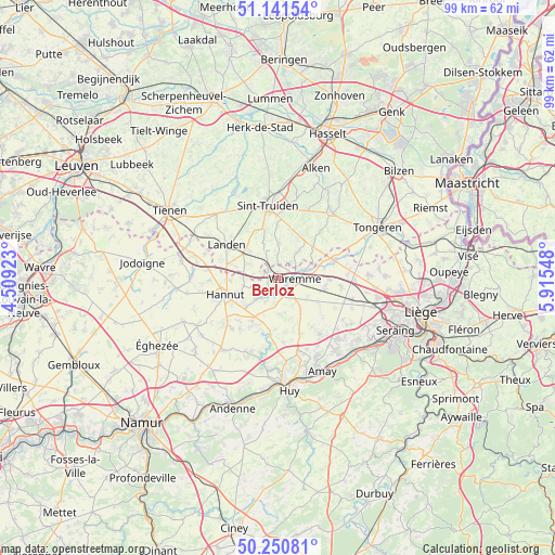
Berloz GPS coordinates[2]
50° 41' 53.844" North, 5° 12' 44.496" East
| Map corner | latitude | longitude |
|---|---|---|
| Upper-left | 51.14154°, | 4.50923° |
| Center: | 50.69829°, | 5.21236° |
| Lower-right: | 50.25081°, | 5.91548° |
| Map W x H: | 99×99 km | = 61.5×61.5mi |
| max Lat: | 51.46791° ⇑59% North |
| Berloz: | 50.69829° |
| min Lat: | ⇓41% South 49.53771° |
| min Long | Berloz | max Long |
| 2.59368° | 5.21236° | 6.25749° |
| W 73.5%⇐ | ⇒26.5% E |
Elevation
Elevation of Berloz is 123 m = 404 ft, and this is 23.5 m = 77 ft above average elevation for this country.
| Max E: |
582 m = 1909 ft | 30% |
| Berloz | 123 m 404 ft | |
| Avg. | 99.5 m = 326 ft | |
Min E: |
1 m = 3 ft | 70% |
See also: Belgium elevation on elevation.city.
Geographical zone
Berloz is located in North temperate zone (between Tropic of Cancer and the Arctic Circle). Distance of this North polar circle is 1764.1 km =1096.2 mi to North.| Distance of | km | miles | from Berloz |
|---|---|---|---|
| North Pole | 4369.9 | 2715.3 | to North |
| Arctic Circle | 1764.1 | 1096.2 | to North |
| Tropic Cancer | 3031.2 | 1883.5 | to South |
| Equator | 5637.1 | 3502.7 | to South |


Nearby cities:
15 places around Berloz: (largest is in red/bold)
• Braives
10.6 km =6.6 mi,  211°
211°
• Crisnée
13.2 km =8.2 mi,  80°
80°
• Donceel
9.4 km =5.8 mi,  126°
126°
• Faimes
5.2 km =3.2 mi,  139°
139°
• Geer
4.2 km =2.6 mi,  220°
220°
• Gingelom
7.8 km =4.8 mi,  315°
315°
• Hannut
9.9 km =6.2 mi,  252°
252°
• Heers
8.8 km =5.5 mi,  45°
45°
• Landen
11 km =6.8 mi,  303°
303°
• Lincent
12.5 km =7.8 mi,  277°
277°
• Oreye
9.8 km =6.1 mi, 77°
• Remicourt
8.4 km =5.2 mi,  103°
103°
• Sint-Truiden
13.3 km =8.3 mi,  352°
352°
• Verlaine
12.5 km =7.8 mi, 143°
• Waremme
3 km =1.9 mi,  91°
91°
Sources, notices
• [Note1] Compared only with cities in Belgium existing in our database
• [Src1] Map data: © OpenStreetMap contributors (CC-BY-SA)
• [Src2] Other city data from geonames.org with taken over terms of usage.
• [Src3] Geographical zone / Annual Mean Temperature by Robert A. Rohde @ Wikipedia
