Mons-lez-Liège geodata
Mons-lez-Liège (Wallonia) is a populated locality; located in Belgium in Europe/Brussels (GMT+2) time zone. With population of 3,595 people, there are 493 cities with bigger population in this country. Compared to other cities in Belgium, 67% of cities are located further ↑North; 83.6% of cities are located further ←West and 73.5% of cities have lower elevation than Mons-lez-Liège. Note1
Administrative division(s):
- Level 1: Wallonia
- Level 2: Province de Liège
- Level 3: Arrondissement de Liège
- Level 4: Flémalle


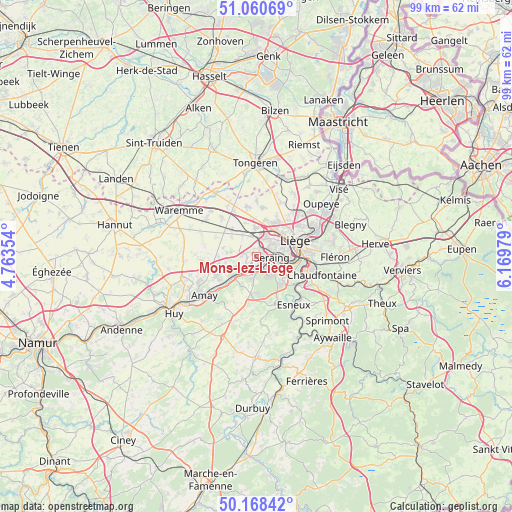
Mons-lez-Liège GPS coordinates[2]
50° 37' 0.012" North, 5° 28' 0.012" East
| Map corner | latitude | longitude |
|---|---|---|
| Upper-left | 51.06069°, | 4.76354° |
| Center: | 50.61667°, | 5.46667° |
| Lower-right: | 50.16842°, | 6.16979° |
| Map W x H: | 99.2×99.2 km | = 61.6×61.6mi |
| max Lat: | 51.46791° ⇑67% North |
| Mons-lez-Liège: | 50.61667° |
| min Lat: | ⇓33% South 49.53771° |
| min Long | Mons-lez-Liège | max Long |
| 2.59368° | 5.46667° | 6.25749° |
| W 83.6%⇐ | ⇒16.4% E |
Elevation
Elevation of Mons-lez-Liège is 137 m = 449 ft, and this is 37.5 m = 123 ft above average elevation for this country.
| Max E: |
582 m = 1909 ft | 26.5% |
| Mons-lez-Liège | 137 m 449 ft | |
| Avg. | 99.5 m = 326 ft | |
Min E: |
1 m = 3 ft | 73.5% |
See also: Belgium elevation on elevation.city.
Geographical zone
Mons-lez-Liège is located in North temperate zone (between Tropic of Cancer and the Arctic Circle). Distance of this North polar circle is 1773.1 km =1101.8 mi to North.| Distance of | km | miles | from Mons-lez-Liège |
|---|---|---|---|
| North Pole | 4379 | 2721 | to North |
| Arctic Circle | 1773.1 | 1101.8 | to North |
| Tropic Cancer | 3022.1 | 1877.8 | to South |
| Equator | 5628 | 3497.1 | to South |


Nearby cities:
15 places around Mons-lez-Liège: (largest is in red/bold)
• Ans
6.3 km =3.9 mi,  36°
36°
• Awans
5.7 km =3.5 mi,  357°
357°
• Crisnée
12.2 km =7.6 mi,  336°
336°
• Donceel
10.9 km =6.8 mi,  288°
288°
• Engis
6.2 km =3.9 mi,  230°
230°
• Esneux
11.5 km =7.1 mi,  141°
141°
• Fexhe-le-Haut-Clocher
7.2 km =4.5 mi,  318°
318°
• Flémalle-Haute
2.4 km =1.5 mi,  219°
219°
• Herstal
12.3 km =7.6 mi,  64°
64°
• Juprelle
11.1 km =6.9 mi,  24°
24°
• Liège
7.4 km =4.6 mi,  75°
75°
• Remicourt
12.1 km =7.5 mi,  306°
306°
• Saint-Nicolas
4.8 km =3 mi,  74°
74°
• Seraing
4.4 km =2.7 mi,  146°
146°
• Verlaine
10.6 km =6.6 mi,  264°
264°
Sources, notices
• [Note1] Compared only with cities in Belgium existing in our database
• [Src1] Map data: © OpenStreetMap contributors (CC-BY-SA)
• [Src2] Other city data from geonames.org with taken over terms of usage.
• [Src3] Geographical zone / Annual Mean Temperature by Robert A. Rohde @ Wikipedia
