Batié geodata
Batié (Sud-Ouest) is a seat of a second-order administrative division; located in Burkina Faso in Africa/Ouagadougou (GMT+0) time zone. With population of 6,483 people, there are 42 cities with bigger population in this country. Compared to other cities in Burkina Faso, 100% of cities are located further ↑North; 84.8% of cities are located further →East and 62% of cities have lower elevation than Batié. Note1


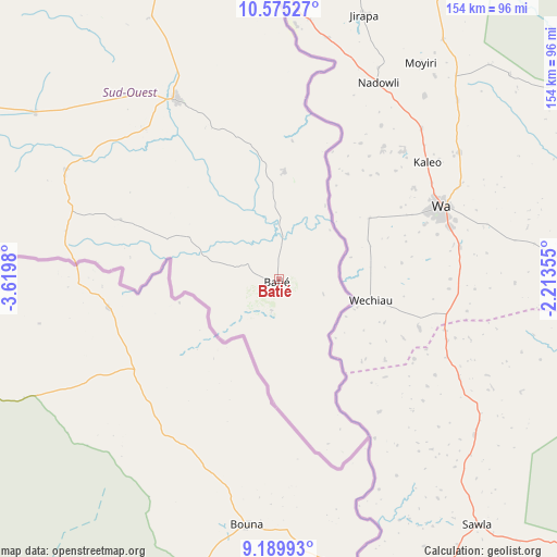
Batié GPS coordinates[2]
9° 52' 59.988" North, 2° 55' 0.012" West
| Map corner | latitude | longitude |
|---|---|---|
| Upper-left | 10.57527°, | -3.6198° |
| Center: | 9.88333°, | -2.91667° |
| Lower-right: | 9.18993°, | -2.21355° |
| Map W x H: | 154×154 km | = 95.7×95.7mi |
| max Lat: | 14.96549° ⇑100% North |
| Batié: | 9.88333° |
| min Lat: | ⇓0% South 9.88333° |
| min Long | Batié | max Long |
| -5.16667° | -2.91667° | 1.78838° |
| W 15.2%⇐ | ⇒84.8% E |
Elevation
Elevation of Batié is 307 m = 1007 ft, and this is 4 m = 13 ft above average elevation for this country.
| Max E: |
423 m = 1388 ft | 38% |
| Batié | 307 m 1007 ft | |
| Avg. | 303 m = 994 ft | |
Min E: |
222 m = 728 ft | 62% |
See also: Burkina Faso elevation on elevation.city.
Geographical zone
Batié is located in North Torrid zone (between Equator and Tropic of Cancer). Distance of Equator is 1098.9 km =682.8 mi to South.| Distance of | km | miles | from Batié |
|---|---|---|---|
| North Pole | 8908.1 | 5535.2 | to North |
| Arctic Circle | 6302.3 | 3916.1 | to North |
| Tropic Cancer | 1507 | 936.4 | to North |
| Equator | 1098.9 | 682.8 | to South |


Nearby cities:
15 places around Batié: (largest is in red/bold)
• Banfora
218.9 km =136 mi,  292°
292°
• Bobo-Dioulasso
208.5 km =129.6 mi,  313°
313°
• Boromo
207.1 km =128.7 mi,  359°
359°
• Dano
141.3 km =87.8 mi,  353°
353°
• Diébougou
125.4 km =77.9 mi,  343°
343°
• Houndé
191.3 km =118.9 mi, 339°
• Kayao
264.3 km =164.2 mi,  26°
26°
• Kokologo
280.9 km =174.5 mi,  23°
23°
• Koudougou
270.3 km =168 mi,  12°
12°
• Léo
161.7 km =100.5 mi, 33°
• Pô
240.8 km =149.6 mi,  53°
53°
• Réo
275.2 km =171 mi, 10°
• Saponé
280.6 km =174.4 mi, 30°
• Sapouy
223.9 km =139.1 mi, 33°
• Sindou
261.1 km =162.2 mi, 289°
Sources, notices
• [Note1] Compared only with cities in Burkina Faso existing in our database
• [Src1] Map data: © OpenStreetMap contributors (CC-BY-SA)
• [Src2] Other city data from geonames.org with taken over terms of usage.
• [Src3] Geographical zone / Annual Mean Temperature by Robert A. Rohde @ Wikipedia
