Banfora geodata
Banfora (Cascades) is a seat of a first-order administrative division; located in Burkina Faso in Africa/Ouagadougou (GMT+0) time zone. With population of 60,288 people, there are 4 cities with bigger population in this country. Compared to other cities in Burkina Faso, 98.7% of cities are located further ↑North; 98.7% of cities are located further →East and 60.8% of cities have higher elevation than Banfora. Note1


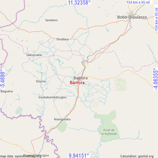
Banfora GPS coordinates[2]
10° 37' 59.988" North, 4° 46' 0.012" West
| Map corner | latitude | longitude |
|---|---|---|
| Upper-left | 11.32358°, | -5.4698° |
| Center: | 10.63333°, | -4.76667° |
| Lower-right: | 9.94151°, | -4.06355° |
| Map W x H: | 153.7×153.7 km | = 95.5×95.5mi |
| max Lat: | 14.96549° ⇑98.7% North |
| Banfora: | 10.63333° |
| min Lat: | ⇓1.3% South 9.88333° |
| min Long | Banfora | max Long |
| -5.16667° | -4.76667° | 1.78838° |
| W 1.3%⇐ | ⇒98.7% E |
Elevation
Elevation of Banfora is 299 m = 981 ft, and this is 4 m = 13 ft below average elevation for this country.
| Max E: |
423 m = 1388 ft | 60.8% |
| Avg. | 303 m = 994 ft | |
| Banfora | 299 m = 981 ft | |
Min E: |
222 m = 728 ft | 39.2% |
See also: Banfora elevation on elevation.city.
Geographical zone
Banfora is located in North Torrid zone (between Equator and Tropic of Cancer). Distance of Equator is 1182.3 km =734.6 mi to South.| Distance of | km | miles | from Banfora |
|---|---|---|---|
| North Pole | 8824.7 | 5483.4 | to North |
| Arctic Circle | 6218.9 | 3864.2 | to North |
| Tropic Cancer | 1423.6 | 884.6 | to North |
| Equator | 1182.3 | 734.6 | to South |


Nearby cities:
15 places around Banfora: (largest is in red/bold)
• Barani
297.6 km =184.9 mi,  18°
18°
• Batié
218.9 km =136 mi,  112°
112°
• Bobo-Dioulasso
79.2 km =49.2 mi,  40°
40°
• Boromo
235.4 km =146.3 mi,  58°
58°
• Dano
195.1 km =121.2 mi,  72°
72°
• Diébougou
169.7 km =105.4 mi,  77°
77°
• Dédougou
248.3 km =154.3 mi,  34°
34°
• Gousi
310.9 km =193.2 mi, 43°
• Houndé
167 km =103.8 mi,  54°
54°
• Léo
295.1 km =183.4 mi, 79°
• Nouna
253 km =157.2 mi, 22°
• Salanso
186.8 km =116.1 mi, 23°
• Sindou
43.9 km =27.3 mi,  274°
274°
• Sièn
306.3 km =190.3 mi, 41°
• Toma
311.8 km =193.7 mi, 40°
Sources, notices
• [Note1] Compared only with cities in Burkina Faso existing in our database
• [Src1] Map data: © OpenStreetMap contributors (CC-BY-SA)
• [Src2] Other city data from geonames.org with taken over terms of usage.
• [Src3] Geographical zone / Annual Mean Temperature by Robert A. Rohde @ Wikipedia
