Machacamarca geodata
Machacamarca (Oruro) is a populated place; located in Bolivia in America/La_Paz (GMT-4) time zone. With population of 2,044 people, there are 105 cities with bigger population in this country. Compared to other cities in Bolivia, 55.9% of cities are located further ↑North; 80.7% of cities are located further →East and 82.6% of cities have lower elevation than Machacamarca. Note1


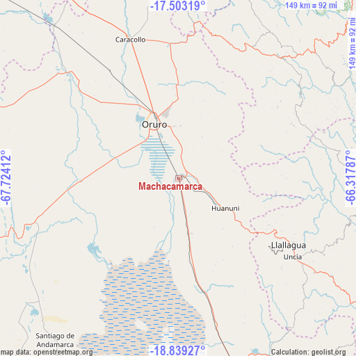
Machacamarca GPS coordinates[2]
18° 10' 21.036" South, 67° 1' 15.564" West
| Map corner | latitude | longitude |
|---|---|---|
| Upper-left | -17.50319°, | -67.72412° |
| Center: | -18.17251°, | -67.02099° |
| Lower-right: | -18.83927°, | -66.31787° |
| Map W x H: | 148.6×148.6 km | = 92.3×92.3mi |
| max Lat: | -9.71828° ⇑55.9% North |
| Machacamarca: | -18.17251° |
| min Lat: | ⇓44.1% South -22.73206° |
| min Long | Machacamarca | max Long |
| -69.14843° | -67.02099° | -57.76667° |
| W 19.3%⇐ | ⇒80.7% E |
Elevation
Elevation of Machacamarca is 3728 m = 12231 ft, and this is 1716.7 m = 5632 ft above average elevation for this country.
| Max E: |
4732 m = 15525 ft | 17.4% |
| Machacamarca | 3728 m 12231 ft | |
| Avg. | 2011.3 m = 6599 ft | |
Min E: |
92 m = 302 ft | 82.6% |
See also: Bolivia elevation on elevation.city.
Geographical zone
Machacamarca is located in South Torrid zone (between Equator and Tropic of Capricorn). Distance of this Southern Tropic circle is 585.3 km =363.7 mi to South.| Distance of | km | miles | from Machacamarca |
|---|---|---|---|
| Equator | 2020.6 | 1255.5 | to North |
| Tropic Capricorn | 585.3 | 363.7 | to South |
| Antarctic Circle | 5380.6 | 3343.3 | to South |
| South Pole | 7986.5 | 4962.6 | to South |


Nearby cities:
15 places around Machacamarca: (largest is in red/bold)
• Andamarca
84.8 km =52.7 mi,  217°
217°
• Belen
105.7 km =65.7 mi,  327°
327°
• Capinota
95.4 km =59.3 mi,  57°
57°
• Challapata
85.3 km =53 mi,  161°
161°
• Colchani
100.5 km =62.4 mi,  18°
18°
• Colquiri
87.8 km =54.6 mi,  352°
352°
• Eucaliptus
83.9 km =52.1 mi,  321°
321°
• Huanuni
23.5 km =14.6 mi,  123°
123°
• Irpa Irpa
94.5 km =58.7 mi, 57°
• Lahuachaca
112.9 km =70.2 mi, 322°
• Llallagua
54 km =33.6 mi, 121°
• Oruro
25.1 km =15.6 mi, 327°
• Poopó
23.8 km =14.8 mi,  166°
166°
• Sipe Sipe
104.9 km =65.2 mi,  40°
40°
• Totoral
39.2 km =24.4 mi, 156°
Sources, notices
• [Note1] Compared only with cities in Bolivia existing in our database
• [Src1] Map data: © OpenStreetMap contributors (CC-BY-SA)
• [Src2] Other city data from geonames.org with taken over terms of usage.
• [Src3] Geographical zone / Annual Mean Temperature by Robert A. Rohde @ Wikipedia
