Totoral geodata
Totoral (Oruro) is a populated place; located in Bolivia in America/La_Paz (GMT-4) time zone. With population of 1,645 people, there are 110 cities with bigger population in this country. Compared to other cities in Bolivia, 61.5% of cities are located further ↑North; 78.3% of cities are located further →East and 93.2% of cities have lower elevation than Totoral. Note1


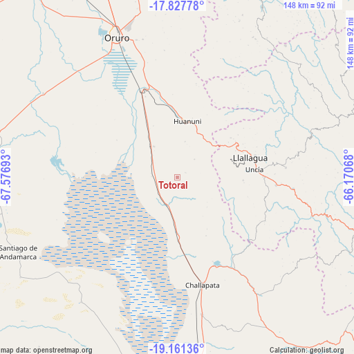
Totoral GPS coordinates[2]
18° 29' 45.132" South, 66° 52' 25.68" West
| Map corner | latitude | longitude |
|---|---|---|
| Upper-left | -17.82778°, | -67.57693° |
| Center: | -18.49587°, | -66.8738° |
| Lower-right: | -19.16136°, | -66.17068° |
| Map W x H: | 148.3×148.3 km | = 92.1×92.1mi |
| max Lat: | -9.71828° ⇑61.5% North |
| Totoral: | -18.49587° |
| min Lat: | ⇓38.5% South -22.73206° |
| min Long | Totoral | max Long |
| -69.14843° | -66.8738° | -57.76667° |
| W 21.7%⇐ | ⇒78.3% E |
Elevation
Elevation of Totoral is 3900 m = 12795 ft, and this is 1888.7 m = 6197 ft above average elevation for this country.
| Max E: |
4732 m = 15525 ft | 6.8% |
| Totoral | 3900 m 12795 ft | |
| Avg. | 2011.3 m = 6599 ft | |
Min E: |
92 m = 302 ft | 93.2% |
See also: Bolivia elevation on elevation.city.
Geographical zone
Totoral is located in South Torrid zone (between Equator and Tropic of Capricorn). Distance of this Southern Tropic circle is 549.4 km =341.4 mi to South.| Distance of | km | miles | from Totoral |
|---|---|---|---|
| Equator | 2056.5 | 1277.8 | to North |
| Tropic Capricorn | 549.4 | 341.4 | to South |
| Antarctic Circle | 5344.6 | 3321 | to South |
| South Pole | 7950.5 | 4940.2 | to South |


Nearby cities:
15 places around Totoral: (largest is in red/bold)
• Andamarca
73.8 km =45.9 mi,  244°
244°
• Capinota
108.7 km =67.5 mi,  36°
36°
• Challapata
46.5 km =28.9 mi,  166°
166°
• Colchani
132.2 km =82.1 mi,  7°
7°
• Colquechaca
94.4 km =58.7 mi,  103°
103°
• Colquiri
125.9 km =78.2 mi,  347°
347°
• Eucaliptus
122.1 km =75.9 mi,  326°
326°
• Huanuni
23.3 km =14.5 mi, 9°
• Irpa Irpa
107.8 km =67 mi, 36°
• Llallagua
31.6 km =19.6 mi,  75°
75°
• Machacamarca
39.2 km =24.4 mi,  336°
336°
• Oruro
64 km =39.8 mi, 332°
• Poopó
16.2 km =10.1 mi,  322°
322°
• Sipe Sipe
127.3 km =79.1 mi,  24°
24°
• Tarata
133.6 km =83 mi, 42°
Sources, notices
• [Note1] Compared only with cities in Bolivia existing in our database
• [Src1] Map data: © OpenStreetMap contributors (CC-BY-SA)
• [Src2] Other city data from geonames.org with taken over terms of usage.
• [Src3] Geographical zone / Annual Mean Temperature by Robert A. Rohde @ Wikipedia
