Andamarca geodata
Andamarca (Oruro) is a seat of a second-order administrative division; located in Bolivia in America/La_Paz (GMT-4) time zone. In our database, there are 117 cities with bigger population. Compared to other cities in Bolivia, 64% of cities are located further ↑North; 83.9% of cities are located further →East and 84.5% of cities have lower elevation than Andamarca. Note1


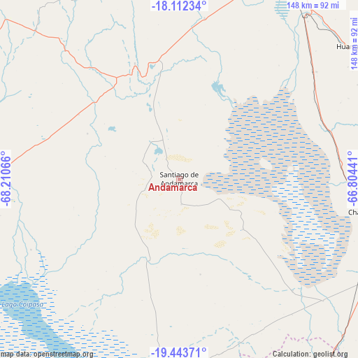
Andamarca GPS coordinates[2]
18° 46' 45.624" South, 67° 30' 27.108" West
| Map corner | latitude | longitude |
|---|---|---|
| Upper-left | -18.11234°, | -68.21066° |
| Center: | -18.77934°, | -67.50753° |
| Lower-right: | -19.44371°, | -66.80441° |
| Map W x H: | 148×148 km | = 92×92mi |
| max Lat: | -9.71828° ⇑64% North |
| Andamarca: | -18.77934° |
| min Lat: | ⇓36% South -22.73206° |
| min Long | Andamarca | max Long |
| -69.14843° | -67.50753° | -57.76667° |
| W 16.1%⇐ | ⇒83.9% E |
Elevation
Elevation of Andamarca is 3751 m = 12306 ft, and this is 1739.7 m = 5708 ft above average elevation for this country.
| Max E: |
4732 m = 15525 ft | 15.5% |
| Andamarca | 3751 m 12306 ft | |
| Avg. | 2011.3 m = 6599 ft | |
Min E: |
92 m = 302 ft | 84.5% |
See also: Bolivia elevation on elevation.city.
Geographical zone
Andamarca is located in South Torrid zone (between Equator and Tropic of Capricorn). Distance of this Southern Tropic circle is 517.9 km =321.8 mi to South.| Distance of | km | miles | from Andamarca |
|---|---|---|---|
| Equator | 2088.1 | 1297.5 | to North |
| Tropic Capricorn | 517.9 | 321.8 | to South |
| Antarctic Circle | 5313.1 | 3301.4 | to South |
| South Pole | 7919 | 4920.6 | to South |


Nearby cities:
15 places around Andamarca: (largest is in red/bold)
• Belen
157.1 km =97.6 mi,  358°
358°
• Challapata
78.8 km =49 mi,  99°
99°
• Colquechaca
158.6 km =98.5 mi,  86°
86°
• Colquiri
159.7 km =99.2 mi,  14°
14°
• Cruz de Machacamarca
96.7 km =60.1 mi,  263°
263°
• Curahuara de Carangas
140.9 km =87.6 mi,  316°
316°
• Eucaliptus
133 km =82.6 mi, 359°
• Huachacalla
79.4 km =49.3 mi,  268°
268°
• Huanuni
89.4 km =55.6 mi,  52°
52°
• Lahuachaca
157.6 km =97.9 mi,  353°
353°
• Llallagua
105 km =65.2 mi,  67°
67°
• Machacamarca
84.8 km =52.7 mi,  37°
37°
• Oruro
96.2 km =59.8 mi,  23°
23°
• Poopó
72.2 km =44.9 mi, 52°
• Totoral
73.8 km =45.9 mi,  64°
64°
Sources, notices
• [Note1] Compared only with cities in Bolivia existing in our database
• [Src1] Map data: © OpenStreetMap contributors (CC-BY-SA)
• [Src2] Other city data from geonames.org with taken over terms of usage.
• [Src3] Geographical zone / Annual Mean Temperature by Robert A. Rohde @ Wikipedia
