Sarandi geodata
Sarandi (Rio Grande do Sul) is a populated place; located in Brazil in America/Sao_Paulo (GMT-3) time zone. With population of 15,158 people, there are 1203 cities with bigger population in this country. Compared to other cities in Brazil, 93.8% of cities are located further ↑North; 90.3% of cities are located further →East and 62.7% of cities have lower elevation than Sarandi. Note1


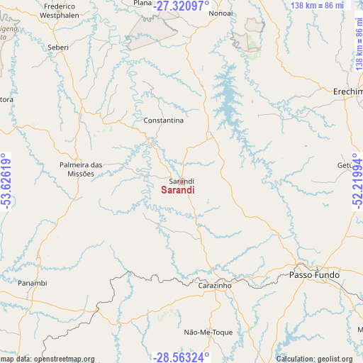
Sarandi GPS coordinates[2]
27° 56' 38.004" South, 52° 55' 23.016" West
| Map corner | latitude | longitude |
|---|---|---|
| Upper-left | -27.32097°, | -53.62619° |
| Center: | -27.94389°, | -52.92306° |
| Lower-right: | -28.56324°, | -52.21994° |
| Map W x H: | 138.1×138.1 km | = 85.8×85.8mi |
| max Lat: | 2.81972° ⇑93.8% North |
| Sarandi: | -27.94389° |
| min Lat: | ⇓6.2% South -33.69111° |
| min Long | Sarandi | max Long |
| -72.89583° | -52.92306° | -32.41083° |
| W 9.7%⇐ | ⇒90.3% E |
Elevation
Elevation of Sarandi is 505 m = 1657 ft, and this is 124.1 m = 407 ft above average elevation for this country.
| Max E: |
1603 m = 5259 ft | 37.3% |
| Sarandi | 505 m 1657 ft | |
| Avg. | 380.9 m = 1250 ft | |
Min E: |
0 m = 0 ft | 62.7% |
See also: Brazil elevation on elevation.city.
Geographical zone
Sarandi is located in South temperate zone (between Tropic of Capricorn and the Antarctic Circle). Distance of this Southern Tropic circle is 501.2 km =311.4 mi to North.| Distance of | km | miles | from Sarandi |
|---|---|---|---|
| Equator | 3107.1 | 1930.7 | to North |
| Tropic Capricorn | 501.2 | 311.4 | to North |
| Antarctic Circle | 4294.1 | 2668.2 | to South |
| South Pole | 6900 | 4287.5 | to South |


Nearby cities:
15 places around Sarandi: (largest is in red/bold)
• Carazinho
40.1 km =24.9 mi,  160°
160°
• Chapecó
98.9 km =61.5 mi,  17°
17°
• Cruz Alta
102.6 km =63.8 mi,  220°
220°
• Erechim
72.4 km =45 mi,  61°
61°
• Espumoso
87.1 km =54.1 mi,  175°
175°
• Frederico Westphalen
79.9 km =49.6 mi,  324°
324°
• Ibirubá
77.7 km =48.3 mi,  192°
192°
• Marau
90.4 km =56.2 mi,  128°
128°
• Não Me Toque
58.2 km =36.2 mi,  170°
170°
• Palmeira das Missões
38.7 km =24 mi,  277°
277°
• Panambi
68.7 km =42.7 mi,  235°
235°
• Passo Fundo
61.8 km =38.4 mi,  124°
124°
• Santo Augusto
84.6 km =52.6 mi, 277°
• Soledade
105.3 km =65.4 mi, 157°
• Tapejara
90.3 km =56.1 mi,  98°
98°
Sources, notices
• [Note1] Compared only with cities in Brazil existing in our database
• [Src1] Map data: © OpenStreetMap contributors (CC-BY-SA)
• [Src2] Other city data from geonames.org with taken over terms of usage.
• [Src3] Geographical zone / Annual Mean Temperature by Robert A. Rohde @ Wikipedia
