Chapecó geodata
Chapecó (Santa Catarina) is a populated place; located in Brazil in America/Sao_Paulo (GMT-3) time zone. With population of 160,157 people, there are 144 cities with bigger population in this country. Compared to other cities in Brazil, 91.4% of cities are located further ↑North; 89.7% of cities are located further →East and 78% of cities have lower elevation than Chapecó. Note1


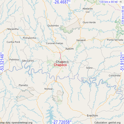
Chapecó GPS coordinates[2]
27° 5' 47.004" South, 52° 37' 5.988" West
| Map corner | latitude | longitude |
|---|---|---|
| Upper-left | -26.4687°, | -53.32146° |
| Center: | -27.09639°, | -52.61833° |
| Lower-right: | -27.72058°, | -51.91521° |
| Map W x H: | 139.2×139.2 km | = 86.5×86.5mi |
| max Lat: | 2.81972° ⇑91.4% North |
| Chapecó: | -27.09639° |
| min Lat: | ⇓8.6% South -33.69111° |
| min Long | Chapecó | max Long |
| -72.89583° | -52.61833° | -32.41083° |
| W 10.3%⇐ | ⇒89.7% E |
Elevation
Elevation of Chapecó is 668 m = 2192 ft, and this is 287.1 m = 942 ft above average elevation for this country.
| Max E: |
1603 m = 5259 ft | 22% |
| Chapecó | 668 m 2192 ft | |
| Avg. | 380.9 m = 1250 ft | |
Min E: |
0 m = 0 ft | 78% |
See also: Chapecó elevation on elevation.city.
Geographical zone
Chapecó is located in South temperate zone (between Tropic of Capricorn and the Antarctic Circle). Distance of this Southern Tropic circle is 406.9 km =252.8 mi to North.| Distance of | km | miles | from Chapecó |
|---|---|---|---|
| Equator | 3012.8 | 1872.1 | to North |
| Tropic Capricorn | 406.9 | 252.8 | to North |
| Antarctic Circle | 4388.3 | 2726.8 | to South |
| South Pole | 6994.2 | 4346 | to South |


Nearby cities:
15 places around Chapecó: (largest is in red/bold)
• Capinzal
103.2 km =64.1 mi,  105°
105°
• Clevelândia
79.3 km =49.3 mi,  10°
10°
• Concórdia
60.4 km =37.5 mi,  104°
104°
• Erechim
68.8 km =42.8 mi,  150°
150°
• Francisco Beltrão
120.9 km =75.1 mi,  338°
338°
• Frederico Westphalen
82.1 km =51 mi,  249°
249°
• Joaçaba
110.6 km =68.7 mi,  94°
94°
• Palmas
92.3 km =57.4 mi,  42°
42°
• Palmeira das Missões
112.6 km =70 mi,  217°
217°
• Pato Branco
96.6 km =60 mi,  356°
356°
• Sananduva
124.1 km =77.1 mi,  139°
139°
• Sarandi
98.9 km =61.5 mi,  197°
197°
• São Lourenço do Oeste
85.2 km =52.9 mi, 344°
• Tapejara
123.4 km =76.7 mi, 151°
• Xanxerê
32.3 km =20.1 mi, 41°
Sources, notices
• [Note1] Compared only with cities in Brazil existing in our database
• [Src1] Map data: © OpenStreetMap contributors (CC-BY-SA)
• [Src2] Other city data from geonames.org with taken over terms of usage.
• [Src3] Geographical zone / Annual Mean Temperature by Robert A. Rohde @ Wikipedia
