Santa Inês geodata
Santa Inês (Bahia) is a populated place; located in Brazil in America/Bahia (GMT-3) time zone. With population of 10,520 people, there are 1599 cities with bigger population in this country. Compared to other cities in Brazil, 59.4% of cities are located further ↓South; 76% of cities are located further ←West and 53.3% of cities have lower elevation than Santa Inês. Note1


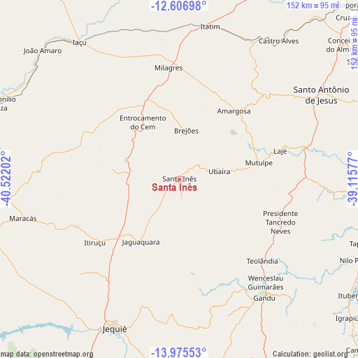
Santa Inês GPS coordinates[2]
13° 17' 31.992" South, 39° 49' 8.004" West
| Map corner | latitude | longitude |
|---|---|---|
| Upper-left | -12.60698°, | -40.52202° |
| Center: | -13.29222°, | -39.81889° |
| Lower-right: | -13.97553°, | -39.11577° |
| Map W x H: | 152.2×152.2 km | = 94.6×94.6mi |
| max Lat: | 2.81972° ⇑40.6% North |
| Santa Inês: | -13.29222° |
| min Lat: | ⇓59.4% South -33.69111° |
| min Long | Santa Inês | max Long |
| -72.89583° | -39.81889° | -32.41083° |
| W 76%⇐ | ⇒24% E |
Elevation
Elevation of Santa Inês is 400 m = 1312 ft, and this is 19.1 m = 63 ft above average elevation for this country.
| Max E: |
1603 m = 5259 ft | 46.7% |
| Santa Inês | 400 m 1312 ft | |
| Avg. | 380.9 m = 1250 ft | |
Min E: |
0 m = 0 ft | 53.3% |
See also: Brazil elevation on elevation.city.
Geographical zone
Santa Inês is located in South Torrid zone (between Equator and Tropic of Capricorn). Distance of this Southern Tropic circle is 1128 km =700.9 mi to South.| Distance of | km | miles | from Santa Inês |
|---|---|---|---|
| Equator | 1478 | 918.4 | to North |
| Tropic Capricorn | 1128 | 700.9 | to South |
| Antarctic Circle | 5923.2 | 3680.5 | to South |
| South Pole | 8529.1 | 5299.7 | to South |


Nearby cities:
15 places around Santa Inês: (largest is in red/bold)
• Amargosa
37.2 km =23.1 mi,  38°
38°
• Castro Alves
72.2 km =44.9 mi, 35°
• Gandu
61.7 km =38.3 mi,  144°
144°
• Iaçu
72.2 km =44.9 mi,  323°
323°
• Itiruçu
44.6 km =27.7 mi,  233°
233°
• Jaguaquara
31.2 km =19.4 mi,  211°
211°
• Jequié
69.3 km =43.1 mi,  204°
204°
• Jitaúna
80.6 km =50.1 mi,  186°
186°
• Maracás
68.2 km =42.4 mi,  255°
255°
• Muritiba
74.4 km =46.2 mi,  55°
55°
• Mutuípe
34.7 km =21.6 mi,  78°
78°
• Santo Antônio de Jesus
70.3 km =43.7 mi, 59°
• Taperoá
82.6 km =51.3 mi,  109°
109°
• Ubaíra
17.1 km =10.6 mi, 80°
• Valença
81.2 km =50.5 mi,  96°
96°
Sources, notices
• [Note1] Compared only with cities in Brazil existing in our database
• [Src1] Map data: © OpenStreetMap contributors (CC-BY-SA)
• [Src2] Other city data from geonames.org with taken over terms of usage.
• [Src3] Geographical zone / Annual Mean Temperature by Robert A. Rohde @ Wikipedia
