Rubiataba geodata
Rubiataba (Goiás) is a populated place; located in Brazil in America/Sao_Paulo (GMT-3) time zone. With population of 16,128 people, there are 1148 cities with bigger population in this country. Compared to other cities in Brazil, 55.8% of cities are located further ↓South; 77.2% of cities are located further →East and 75.9% of cities have lower elevation than Rubiataba. Note1


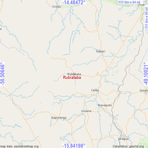
Rubiataba GPS coordinates[2]
15° 9' 51.984" South, 49° 48' 11.988" West
| Map corner | latitude | longitude |
|---|---|---|
| Upper-left | -14.48472°, | -50.50646° |
| Center: | -15.16444°, | -49.80333° |
| Lower-right: | -15.84198°, | -49.10021° |
| Map W x H: | 150.9×150.9 km | = 93.8×93.8mi |
| max Lat: | 2.81972° ⇑44.2% North |
| Rubiataba: | -15.16444° |
| min Lat: | ⇓55.8% South -33.69111° |
| min Long | Rubiataba | max Long |
| -72.89583° | -49.80333° | -32.41083° |
| W 22.8%⇐ | ⇒77.2% E |
Elevation
Elevation of Rubiataba is 638 m = 2093 ft, and this is 257.1 m = 844 ft above average elevation for this country.
| Max E: |
1603 m = 5259 ft | 24.1% |
| Rubiataba | 638 m 2093 ft | |
| Avg. | 380.9 m = 1250 ft | |
Min E: |
0 m = 0 ft | 75.9% |
See also: Brazil elevation on elevation.city.
Geographical zone
Rubiataba is located in South Torrid zone (between Equator and Tropic of Capricorn). Distance of this Southern Tropic circle is 919.8 km =571.5 mi to South.| Distance of | km | miles | from Rubiataba |
|---|---|---|---|
| Equator | 1686.1 | 1047.7 | to North |
| Tropic Capricorn | 919.8 | 571.5 | to South |
| Antarctic Circle | 5715 | 3551.1 | to South |
| South Pole | 8320.9 | 5170.4 | to South |


Nearby cities:
15 places around Rubiataba: (largest is in red/bold)
• Barro Alto
97.7 km =60.7 mi,  77°
77°
• Carmo do Rio Verde
23.4 km =14.5 mi,  153°
153°
• Ceres
27.2 km =16.9 mi,  126°
126°
• Crixás
70.7 km =43.9 mi,  345°
345°
• Goianésia
75.5 km =46.9 mi,  103°
103°
• Goiás
92.9 km =57.7 mi,  202°
202°
• Itaberaí
95.2 km =59.2 mi,  180°
180°
• Itapaci
36.2 km =22.5 mi,  48°
48°
• Itapirapuã
113.6 km =70.6 mi,  229°
229°
• Itapuranga
46.9 km =29.1 mi, 199°
• Jaraguá
82.9 km =51.5 mi,  142°
142°
• Mozarlândia
94.7 km =58.8 mi,  299°
299°
• Rialma
28.8 km =17.9 mi, 125°
• Uruana
39.9 km =24.8 mi,  161°
161°
• Uruaçu
100.6 km =62.5 mi, 45°
Sources, notices
• [Note1] Compared only with cities in Brazil existing in our database
• [Src1] Map data: © OpenStreetMap contributors (CC-BY-SA)
• [Src2] Other city data from geonames.org with taken over terms of usage.
• [Src3] Geographical zone / Annual Mean Temperature by Robert A. Rohde @ Wikipedia
