Itapuranga geodata
Itapuranga (Goiás) is a populated place; located in Brazil in America/Sao_Paulo (GMT-3) time zone. With population of 19,709 people, there are 951 cities with bigger population in this country. Compared to other cities in Brazil, 54.8% of cities are located further ↓South; 78% of cities are located further →East and 76.9% of cities have lower elevation than Itapuranga. Note1


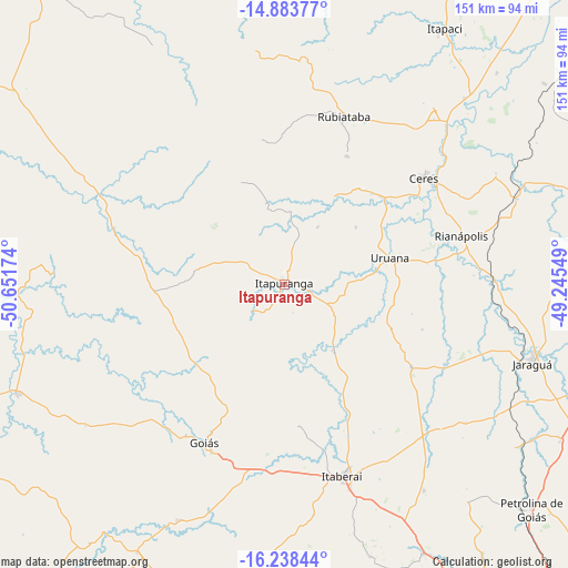
Itapuranga GPS coordinates[2]
15° 33' 43.992" South, 49° 56' 54.996" West
| Map corner | latitude | longitude |
|---|---|---|
| Upper-left | -14.88377°, | -50.65174° |
| Center: | -15.56222°, | -49.94861° |
| Lower-right: | -16.23844°, | -49.24549° |
| Map W x H: | 150.6×150.6 km | = 93.6×93.6mi |
| max Lat: | 2.81972° ⇑45.2% North |
| Itapuranga: | -15.56222° |
| min Lat: | ⇓54.8% South -33.69111° |
| min Long | Itapuranga | max Long |
| -72.89583° | -49.94861° | -32.41083° |
| W 22%⇐ | ⇒78% E |
Elevation
Elevation of Itapuranga is 652 m = 2139 ft, and this is 271.1 m = 889 ft above average elevation for this country.
| Max E: |
1603 m = 5259 ft | 23.1% |
| Itapuranga | 652 m 2139 ft | |
| Avg. | 380.9 m = 1250 ft | |
Min E: |
0 m = 0 ft | 76.9% |
See also: Brazil elevation on elevation.city.
Geographical zone
Itapuranga is located in South Torrid zone (between Equator and Tropic of Capricorn). Distance of this Southern Tropic circle is 875.6 km =544.1 mi to South.| Distance of | km | miles | from Itapuranga |
|---|---|---|---|
| Equator | 1730.4 | 1075.2 | to North |
| Tropic Capricorn | 875.6 | 544.1 | to South |
| Antarctic Circle | 5670.8 | 3523.7 | to South |
| South Pole | 8276.7 | 5142.9 | to South |


Nearby cities:
15 places around Itapuranga: (largest is in red/bold)
• Anicuns
100 km =62.1 mi,  180°
180°
• Carmo do Rio Verde
34.7 km =21.6 mi,  48°
48°
• Ceres
47 km =29.2 mi, 53°
• Goianésia
93.1 km =57.8 mi,  73°
73°
• Goiás
46.2 km =28.7 mi,  206°
206°
• Inhumas
100.8 km =62.6 mi,  151°
151°
• Itaberaí
53 km =32.9 mi,  163°
163°
• Itapaci
80.3 km =49.9 mi,  32°
32°
• Itapirapuã
76.8 km =47.7 mi,  247°
247°
• Jaraguá
69.2 km =43 mi,  108°
108°
• Petrolina de Goiás
88.2 km =54.8 mi,  132°
132°
• Pirenópolis
110.5 km =68.7 mi, 106°
• Rialma
47.7 km =29.6 mi, 54°
• Rubiataba
46.9 km =29.1 mi,  19°
19°
• Uruana
29.2 km =18.1 mi,  77°
77°
Sources, notices
• [Note1] Compared only with cities in Brazil existing in our database
• [Src1] Map data: © OpenStreetMap contributors (CC-BY-SA)
• [Src2] Other city data from geonames.org with taken over terms of usage.
• [Src3] Geographical zone / Annual Mean Temperature by Robert A. Rohde @ Wikipedia
