Prata geodata
Prata (Minas Gerais) is a populated place; located in Brazil in America/Sao_Paulo (GMT-3) time zone. With population of 19,896 people, there are 944 cities with bigger population in this country. Compared to other cities in Brazil, 53.9% of cities are located further ↑North; 70.9% of cities are located further →East and 76.2% of cities have lower elevation than Prata. Note1


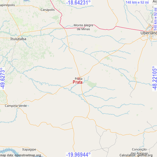
Prata GPS coordinates[2]
19° 18' 25.992" South, 48° 55' 27.012" West
| Map corner | latitude | longitude |
|---|---|---|
| Upper-left | -18.64231°, | -49.6273° |
| Center: | -19.30722°, | -48.92417° |
| Lower-right: | -19.96944°, | -48.22105° |
| Map W x H: | 147.6×147.6 km | = 91.7×91.7mi |
| max Lat: | 2.81972° ⇑53.9% North |
| Prata: | -19.30722° |
| min Lat: | ⇓46.1% South -33.69111° |
| min Long | Prata | max Long |
| -72.89583° | -48.92417° | -32.41083° |
| W 29.1%⇐ | ⇒70.9% E |
Elevation
Elevation of Prata is 642 m = 2106 ft, and this is 261.1 m = 857 ft above average elevation for this country.
| Max E: |
1603 m = 5259 ft | 23.8% |
| Prata | 642 m 2106 ft | |
| Avg. | 380.9 m = 1250 ft | |
Min E: |
0 m = 0 ft | 76.2% |
See also: Brazil elevation on elevation.city.
Geographical zone
Prata is located in South Torrid zone (between Equator and Tropic of Capricorn). Distance of this Southern Tropic circle is 459.2 km =285.3 mi to South.| Distance of | km | miles | from Prata |
|---|---|---|---|
| Equator | 2146.8 | 1334 | to North |
| Tropic Capricorn | 459.2 | 285.3 | to South |
| Antarctic Circle | 5254.4 | 3264.9 | to South |
| South Pole | 7860.3 | 4884.2 | to South |


Nearby cities:
15 places around Prata: (largest is in red/bold)
• Araguari
106.7 km =66.3 mi,  46°
46°
• Buriti Alegre
130.4 km =81 mi,  354°
354°
• Campina Verde
64.5 km =40.1 mi,  246°
246°
• Capinópolis
97.2 km =60.4 mi,  315°
315°
• Centralina
85.5 km =53.1 mi,  340°
340°
• Conceição das Alagoas
87.8 km =54.6 mi,  140°
140°
• Frutal
79.8 km =49.6 mi,  181°
181°
• Guaíra
129.5 km =80.5 mi,  150°
150°
• Ituiutaba
67.6 km =42 mi,  303°
303°
• Itumbiara
103.4 km =64.2 mi, 342°
• Monte Alegre de Minas
48.8 km =30.3 mi,  5°
5°
• Riolândia
109.1 km =67.8 mi,  226°
226°
• Tupaciguara
82.8 km =51.4 mi,  16°
16°
• Uberaba
115 km =71.5 mi,  115°
115°
• Uberlândia
80.5 km =50 mi,  57°
57°
Sources, notices
• [Note1] Compared only with cities in Brazil existing in our database
• [Src1] Map data: © OpenStreetMap contributors (CC-BY-SA)
• [Src2] Other city data from geonames.org with taken over terms of usage.
• [Src3] Geographical zone / Annual Mean Temperature by Robert A. Rohde @ Wikipedia
