Buriti Alegre geodata
Buriti Alegre (Goiás) is a populated place; located in Brazil in America/Sao_Paulo (GMT-3) time zone. With population of 9,427 people, there are 1692 cities with bigger population in this country. Compared to other cities in Brazil, 51.3% of cities are located further ↑North; 71.6% of cities are located further →East and 89.4% of cities have lower elevation than Buriti Alegre. Note1


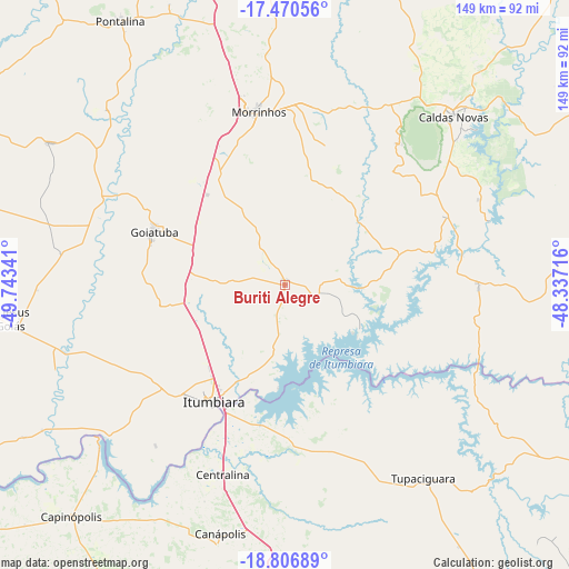
Buriti Alegre GPS coordinates[2]
18° 8' 24" South, 49° 2' 25.008" West
| Map corner | latitude | longitude |
|---|---|---|
| Upper-left | -17.47056°, | -49.74341° |
| Center: | -18.14°, | -49.04028° |
| Lower-right: | -18.80689°, | -48.33716° |
| Map W x H: | 148.6×148.6 km | = 92.3×92.3mi |
| max Lat: | 2.81972° ⇑51.3% North |
| Buriti Alegre: | -18.14° |
| min Lat: | ⇓48.7% South -33.69111° |
| min Long | Buriti Alegre | max Long |
| -72.89583° | -49.04028° | -32.41083° |
| W 28.4%⇐ | ⇒71.6% E |
Elevation
Elevation of Buriti Alegre is 802 m = 2631 ft, and this is 421.1 m = 1382 ft above average elevation for this country.
| Max E: |
1603 m = 5259 ft | 10.6% |
| Buriti Alegre | 802 m 2631 ft | |
| Avg. | 380.9 m = 1250 ft | |
Min E: |
0 m = 0 ft | 89.4% |
See also: Brazil elevation on elevation.city.
Geographical zone
Buriti Alegre is located in South Torrid zone (between Equator and Tropic of Capricorn). Distance of this Southern Tropic circle is 588.9 km =365.9 mi to South.| Distance of | km | miles | from Buriti Alegre |
|---|---|---|---|
| Equator | 2017 | 1253.3 | to North |
| Tropic Capricorn | 588.9 | 365.9 | to South |
| Antarctic Circle | 5384.2 | 3345.6 | to South |
| South Pole | 7990.1 | 4964.8 | to South |


Nearby cities:
15 places around Buriti Alegre: (largest is in red/bold)
• Araguari
106.2 km =66 mi,  122°
122°
• Caldas Novas
62 km =38.5 mi,  44°
44°
• Capinópolis
82.2 km =51.1 mi,  222°
222°
• Catalão
115.6 km =71.8 mi,  91°
91°
• Centralina
52.1 km =32.4 mi,  198°
198°
• Goiatuba
36.1 km =22.4 mi,  293°
293°
• Ipameri
104.1 km =64.7 mi,  63°
63°
• Ituiutaba
102.9 km =63.9 mi,  205°
205°
• Itumbiara
36.1 km =22.4 mi, 210°
• Monte Alegre de Minas
83 km =51.6 mi,  168°
168°
• Morrinhos
45.9 km =28.5 mi,  352°
352°
• Piracanjuba
93.1 km =57.8 mi,  1°
1°
• Pontalina
80.8 km =50.2 mi,  327°
327°
• Tupaciguara
61.5 km =38.2 mi,  144°
144°
• Uberlândia
118.2 km =73.4 mi, 137°
Sources, notices
• [Note1] Compared only with cities in Brazil existing in our database
• [Src1] Map data: © OpenStreetMap contributors (CC-BY-SA)
• [Src2] Other city data from geonames.org with taken over terms of usage.
• [Src3] Geographical zone / Annual Mean Temperature by Robert A. Rohde @ Wikipedia
