Riolândia geodata
Riolândia (São Paulo) is a populated place; located in Brazil in America/Sao_Paulo (GMT-3) time zone. With population of 10,575 people, there are 1596 cities with bigger population in this country. Compared to other cities in Brazil, 57% of cities are located further ↑North; 76.7% of cities are located further →East and 57.1% of cities have lower elevation than Riolândia. Note1


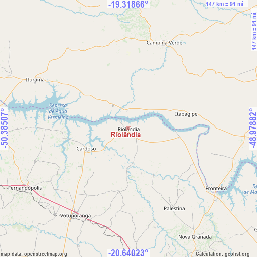
Riolândia GPS coordinates[2]
19° 58' 50.988" South, 49° 40' 54.984" West
| Map corner | latitude | longitude |
|---|---|---|
| Upper-left | -19.31866°, | -50.38507° |
| Center: | -19.98083°, | -49.68194° |
| Lower-right: | -20.64023°, | -48.97882° |
| Map W x H: | 146.9×146.9 km | = 91.3×91.3mi |
| max Lat: | 2.81972° ⇑57% North |
| Riolândia: | -19.98083° |
| min Lat: | ⇓43% South -33.69111° |
| min Long | Riolândia | max Long |
| -72.89583° | -49.68194° | -32.41083° |
| W 23.3%⇐ | ⇒76.7% E |
Elevation
Elevation of Riolândia is 443 m = 1453 ft, and this is 62.1 m = 204 ft above average elevation for this country.
| Max E: |
1603 m = 5259 ft | 42.9% |
| Riolândia | 443 m 1453 ft | |
| Avg. | 380.9 m = 1250 ft | |
Min E: |
0 m = 0 ft | 57.1% |
See also: Brazil elevation on elevation.city.
Geographical zone
Riolândia is located in South Torrid zone (between Equator and Tropic of Capricorn). Distance of this Southern Tropic circle is 384.3 km =238.8 mi to South.| Distance of | km | miles | from Riolândia |
|---|---|---|---|
| Equator | 2221.7 | 1380.5 | to North |
| Tropic Capricorn | 384.3 | 238.8 | to South |
| Antarctic Circle | 5179.5 | 3218.4 | to South |
| South Pole | 7785.4 | 4837.6 | to South |


Nearby cities:
15 places around Riolândia: (largest is in red/bold)
• Bady Bassitt
107.1 km =66.5 mi,  166°
166°
• Campina Verde
53.3 km =33.1 mi,  22°
22°
• Cardoso
26.7 km =16.6 mi,  245°
245°
• Fernandópolis
67.9 km =42.2 mi,  240°
240°
• Frutal
77.6 km =48.2 mi,  93°
93°
• General Salgado
102.5 km =63.7 mi,  223°
223°
• Guapiaçu
102.5 km =63.7 mi,  152°
152°
• Iturama
60.6 km =37.7 mi,  297°
297°
• Jales
95.7 km =59.5 mi, 250°
• Monte Aprazível
88.1 km =54.7 mi,  182°
182°
• Nhandeara
87.2 km =54.2 mi,  205°
205°
• Nova Granada
72.5 km =45 mi, 148°
• São José do Rio Preto
98.5 km =61.2 mi,  161°
161°
• Tanabi
71.9 km =44.7 mi, 177°
• Votuporanga
57.8 km =35.9 mi, 211°
Sources, notices
• [Note1] Compared only with cities in Brazil existing in our database
• [Src1] Map data: © OpenStreetMap contributors (CC-BY-SA)
• [Src2] Other city data from geonames.org with taken over terms of usage.
• [Src3] Geographical zone / Annual Mean Temperature by Robert A. Rohde @ Wikipedia
