Tupaciguara geodata
Tupaciguara (Minas Gerais) is a populated place; located in Brazil in America/Sao_Paulo (GMT-3) time zone. With population of 24,398 people, there are 797 cities with bigger population in this country. Compared to other cities in Brazil, 52.1% of cities are located further ↑North; 69.5% of cities are located further →East and 93.3% of cities have lower elevation than Tupaciguara. Note1


Tupaciguara GPS coordinates[2]
18° 35' 31.992" South, 48° 42' 18" West
| Map corner | latitude | longitude |
|---|---|---|
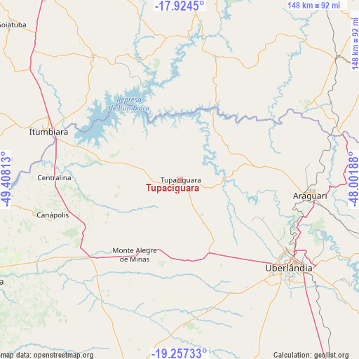
| Upper-left | -17.9245°, | -49.40813° |
| Center: | -18.59222°, | -48.705° |
| Lower-right: | -19.25733°, | -48.00188° |
| Map W x H: | 148.2×148.2 km | = 92.1×92.1mi |
| max Lat: | 2.81972° ⇑52.1% North |
| Tupaciguara: | -18.59222° |
| min Lat: | ⇓47.9% South -33.69111° |
| min Long | Tupaciguara | max Long |
| -72.89583° | -48.705° | -32.41083° |
| W 30.5%⇐ | ⇒69.5% E |
Elevation
Elevation of Tupaciguara is 871 m = 2858 ft, and this is 490.1 m = 1608 ft above average elevation for this country.
| Max E: |
1603 m = 5259 ft | 6.7% |
| Tupaciguara | 871 m 2858 ft | |
| Avg. | 380.9 m = 1250 ft | |
Min E: |
0 m = 0 ft | 93.3% |
See also: Brazil elevation on elevation.city.
Geographical zone
Tupaciguara is located in South Torrid zone (between Equator and Tropic of Capricorn). Distance of this Southern Tropic circle is 538.7 km =334.7 mi to South.| Distance of | km | miles | from Tupaciguara |
|---|---|---|---|
| Equator | 2067.3 | 1284.6 | to North |
| Tropic Capricorn | 538.7 | 334.7 | to South |
| Antarctic Circle | 5333.9 | 3314.3 | to South |
| South Pole | 7939.8 | 4933.6 | to South |


Nearby cities:
15 places around Tupaciguara: (largest is in red/bold)
• Araguari
54.9 km =34.1 mi,  96°
96°
• Buriti Alegre
61.5 km =38.2 mi,  324°
324°
• Caldas Novas
94.6 km =58.8 mi,  4°
4°
• Capinópolis
91.7 km =57 mi,  263°
263°
• Catalão
93 km =57.8 mi,  59°
59°
• Centralina
52.1 km =32.4 mi,  271°
271°
• Goiatuba
94.1 km =58.5 mi,  313°
313°
• Ipameri
112.6 km =70 mi,  30°
30°
• Ituiutaba
90.3 km =56.1 mi,  241°
241°
• Itumbiara
57.1 km =35.5 mi,  289°
289°
• Monte Alegre de Minas
36.1 km =22.4 mi,  210°
210°
• Monte Carmelo
127.9 km =79.5 mi, 96°
• Morrinhos
104.4 km =64.9 mi,  336°
336°
• Prata
82.8 km =51.4 mi,  196°
196°
• Uberlândia
57.8 km =35.9 mi,  128°
128°
Sources, notices
• [Note1] Compared only with cities in Brazil existing in our database
• [Src1] Map data: © OpenStreetMap contributors (CC-BY-SA)
• [Src2] Other city data from geonames.org with taken over terms of usage.
• [Src3] Geographical zone / Annual Mean Temperature by Robert A. Rohde @ Wikipedia
