Lajinha geodata
Lajinha (Minas Gerais) is a populated place; located in Brazil in America/Sao_Paulo (GMT-3) time zone. With population of 15,729 people, there are 1172 cities with bigger population in this country. Compared to other cities in Brazil, 58.1% of cities are located further ↑North; 67.7% of cities are located further ←West and 61.5% of cities have lower elevation than Lajinha. Note1


Lajinha GPS coordinates[2]
20° 9' 5.004" South, 41° 37' 22.008" West
| Map corner | latitude | longitude |
|---|---|---|
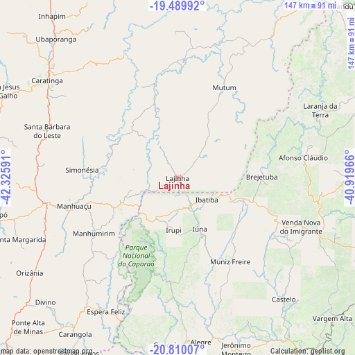
| Upper-left | -19.48992°, | -42.32591° |
| Center: | -20.15139°, | -41.62278° |
| Lower-right: | -20.81007°, | -40.91966° |
| Map W x H: | 146.8×146.8 km | = 91.2×91.2mi |
| max Lat: | 2.81972° ⇑58.1% North |
| Lajinha: | -20.15139° |
| min Lat: | ⇓41.9% South -33.69111° |
| min Long | Lajinha | max Long |
| -72.89583° | -41.62278° | -32.41083° |
| W 67.7%⇐ | ⇒32.3% E |
Elevation
Elevation of Lajinha is 491 m = 1611 ft, and this is 110.1 m = 361 ft above average elevation for this country.
| Max E: |
1603 m = 5259 ft | 38.5% |
| Lajinha | 491 m 1611 ft | |
| Avg. | 380.9 m = 1250 ft | |
Min E: |
0 m = 0 ft | 61.5% |
See also: Brazil elevation on elevation.city.
Geographical zone
Lajinha is located in South Torrid zone (between Equator and Tropic of Capricorn). Distance of this Southern Tropic circle is 365.3 km =227 mi to South.| Distance of | km | miles | from Lajinha |
|---|---|---|---|
| Equator | 2240.6 | 1392.2 | to North |
| Tropic Capricorn | 365.3 | 227 | to South |
| Antarctic Circle | 5160.5 | 3206.6 | to South |
| South Pole | 7766.4 | 4825.8 | to South |


Nearby cities:
15 places around Lajinha: (largest is in red/bold)
• Afonso Cláudio
52.8 km =32.8 mi,  80°
80°
• Alegre
68.7 km =42.7 mi,  172°
172°
• Caratinga
67.3 km =41.8 mi,  306°
306°
• Castelo
67.9 km =42.2 mi,  137°
137°
• Conceição do Castelo
46.3 km =28.8 mi,  121°
121°
• Espera Feliz
62.9 km =39.1 mi,  208°
208°
• Guaçuí
69.7 km =43.3 mi,  184°
184°
• Ibatiba
14.9 km =9.3 mi,  128°
128°
• Irupi
21.6 km =13.4 mi,  185°
185°
• Iúna
23.4 km =14.5 mi,  157°
157°
• Laranja da Terra
65.5 km =40.7 mi,  64°
64°
• Manhuaçu
44.5 km =27.7 mi,  254°
254°
• Manhumirim
41.8 km =26 mi,  236°
236°
• Muniz Freire
41.1 km =25.5 mi,  147°
147°
• Mutum
43.6 km =27.1 mi,  26°
26°
Sources, notices
• [Note1] Compared only with cities in Brazil existing in our database
• [Src1] Map data: © OpenStreetMap contributors (CC-BY-SA)
• [Src2] Other city data from geonames.org with taken over terms of usage.
• [Src3] Geographical zone / Annual Mean Temperature by Robert A. Rohde @ Wikipedia
