Jataí geodata
Jataí (Goiás) is a populated place; located in Brazil in America/Sao_Paulo (GMT-3) time zone. With population of 76,547 people, there are 297 cities with bigger population in this country. Compared to other cities in Brazil, 50.9% of cities are located further ↑North; 86.5% of cities are located further →East and 83.6% of cities have lower elevation than Jataí. Note1


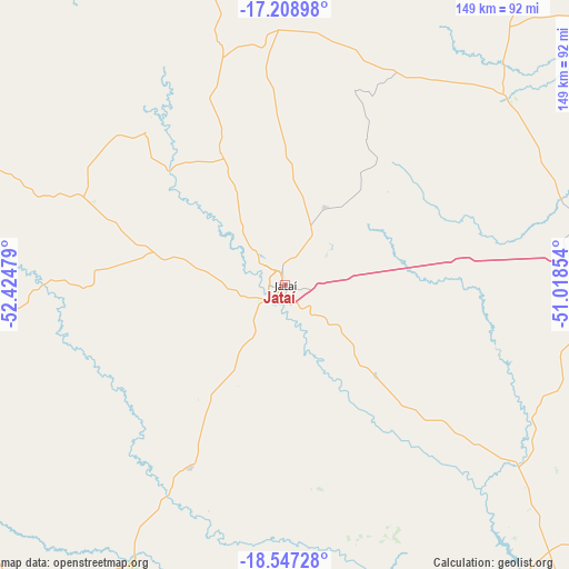
Jataí GPS coordinates[2]
17° 52' 45.804" South, 51° 43' 17.976" West
| Map corner | latitude | longitude |
|---|---|---|
| Upper-left | -17.20898°, | -52.42479° |
| Center: | -17.87939°, | -51.72166° |
| Lower-right: | -18.54728°, | -51.01854° |
| Map W x H: | 148.8×148.8 km | = 92.5×92.5mi |
| max Lat: | 2.81972° ⇑50.9% North |
| Jataí: | -17.87939° |
| min Lat: | ⇓49.1% South -33.69111° |
| min Long | Jataí | max Long |
| -72.89583° | -51.72166° | -32.41083° |
| W 13.5%⇐ | ⇒86.5% E |
Elevation
Elevation of Jataí is 741 m = 2431 ft, and this is 360.1 m = 1181 ft above average elevation for this country.
| Max E: |
1603 m = 5259 ft | 16.4% |
| Jataí | 741 m 2431 ft | |
| Avg. | 380.9 m = 1250 ft | |
Min E: |
0 m = 0 ft | 83.6% |
See also: Jataí elevation on elevation.city.
Geographical zone
Jataí is located in South Torrid zone (between Equator and Tropic of Capricorn). Distance of this Southern Tropic circle is 617.9 km =383.9 mi to South.| Distance of | km | miles | from Jataí |
|---|---|---|---|
| Equator | 1988 | 1235.3 | to North |
| Tropic Capricorn | 617.9 | 383.9 | to South |
| Antarctic Circle | 5413.2 | 3363.6 | to South |
| South Pole | 8019.1 | 4982.8 | to South |


Nearby cities:
15 places around Jataí: (largest is in red/bold)
• Alto Araguaia
170.3 km =105.8 mi,  291°
291°
• Caiapônia
103 km =64 mi,  354°
354°
• Cassilândia
137.2 km =85.3 mi,  180°
180°
• Caçu
97.8 km =60.8 mi,  140°
140°
• Edéia
199 km =123.7 mi,  72°
72°
• Iporá
172.2 km =107 mi,  21°
21°
• Mineiros
94.4 km =58.7 mi, 291°
• Paraíso das Águas
185.9 km =115.5 mi,  227°
227°
• Paraúna
170.2 km =105.8 mi,  52°
52°
• Piranhas
161.9 km =100.6 mi,  356°
356°
• Portelândia
117.1 km =72.8 mi,  299°
299°
• Quirinópolis
148.3 km =92.1 mi,  115°
115°
• Rio Verde
84.5 km =52.5 mi,  83°
83°
• Santa Helena de Goiás
119.3 km =74.1 mi,  86°
86°
• Santa Vitória
199.7 km =124.1 mi, 122°
Sources, notices
• [Note1] Compared only with cities in Brazil existing in our database
• [Src1] Map data: © OpenStreetMap contributors (CC-BY-SA)
• [Src2] Other city data from geonames.org with taken over terms of usage.
• [Src3] Geographical zone / Annual Mean Temperature by Robert A. Rohde @ Wikipedia
