Iporá geodata
Iporá (Goiás) is a populated place; located in Brazil in America/Sao_Paulo (GMT-3) time zone. With population of 28,254 people, there are 700 cities with bigger population in this country. Compared to other cities in Brazil, 52.3% of cities are located further ↓South; 83.2% of cities are located further →East and 72.2% of cities have lower elevation than Iporá. Note1


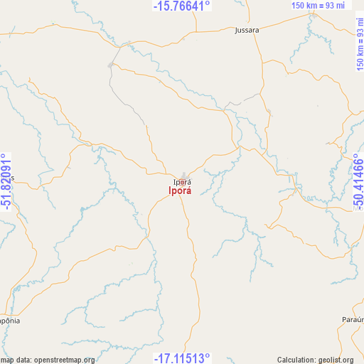
Iporá GPS coordinates[2]
16° 26' 30.984" South, 51° 7' 4.008" West
| Map corner | latitude | longitude |
|---|---|---|
| Upper-left | -15.76641°, | -51.82091° |
| Center: | -16.44194°, | -51.11778° |
| Lower-right: | -17.11513°, | -50.41466° |
| Map W x H: | 150×150 km | = 93.2×93.2mi |
| max Lat: | 2.81972° ⇑47.7% North |
| Iporá: | -16.44194° |
| min Lat: | ⇓52.3% South -33.69111° |
| min Long | Iporá | max Long |
| -72.89583° | -51.11778° | -32.41083° |
| W 16.8%⇐ | ⇒83.2% E |
Elevation
Elevation of Iporá is 594 m = 1949 ft, and this is 213.1 m = 699 ft above average elevation for this country.
| Max E: |
1603 m = 5259 ft | 27.8% |
| Iporá | 594 m 1949 ft | |
| Avg. | 380.9 m = 1250 ft | |
Min E: |
0 m = 0 ft | 72.2% |
See also: Brazil elevation on elevation.city.
Geographical zone
Iporá is located in South Torrid zone (between Equator and Tropic of Capricorn). Distance of this Southern Tropic circle is 777.7 km =483.2 mi to South.| Distance of | km | miles | from Iporá |
|---|---|---|---|
| Equator | 1828.2 | 1136 | to North |
| Tropic Capricorn | 777.7 | 483.2 | to South |
| Antarctic Circle | 5573 | 3462.9 | to South |
| South Pole | 8178.9 | 5082.1 | to South |


Nearby cities:
15 places around Iporá: (largest is in red/bold)
• Anicuns
123.3 km =76.6 mi,  90°
90°
• Aragarças
135.3 km =84.1 mi,  296°
296°
• Araguaiana
109.6 km =68.1 mi,  315°
315°
• Barra do Garças
136.2 km =84.6 mi, 296°
• Caiapônia
93.4 km =58 mi,  232°
232°
• Firminópolis
88 km =54.7 mi,  100°
100°
• Goiás
118.7 km =73.8 mi,  61°
61°
• Itaberaí
147.2 km =91.5 mi,  71°
71°
• Itapirapuã
87.4 km =54.3 mi,  38°
38°
• Itapuranga
158.7 km =98.6 mi,  51°
51°
• Palmeiras de Goiás
133.3 km =82.8 mi,  107°
107°
• Paraúna
90.8 km =56.4 mi,  128°
128°
• Piranhas
75.1 km =46.7 mi,  271°
271°
• Rio Verde
152.1 km =94.5 mi,  172°
172°
• São Luís de Montes Belos
80 km =49.7 mi, 96°
Sources, notices
• [Note1] Compared only with cities in Brazil existing in our database
• [Src1] Map data: © OpenStreetMap contributors (CC-BY-SA)
• [Src2] Other city data from geonames.org with taken over terms of usage.
• [Src3] Geographical zone / Annual Mean Temperature by Robert A. Rohde @ Wikipedia
