Itapeva geodata
Itapeva (São Paulo) is a populated place; located in Brazil in America/Sao_Paulo (GMT-3) time zone. With population of 62,957 people, there are 358 cities with bigger population in this country. Compared to other cities in Brazil, 85.9% of cities are located further ↑North; 70.6% of cities are located further →East and 79.9% of cities have lower elevation than Itapeva. Note1


Itapeva GPS coordinates[2]
23° 58' 55.992" South, 48° 52' 32.016" West
| Map corner | latitude | longitude |
|---|---|---|
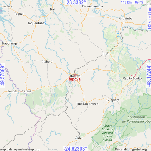
| Upper-left | -23.3382°, | -49.57869° |
| Center: | -23.98222°, | -48.87556° |
| Lower-right: | -24.62303°, | -48.17244° |
| Map W x H: | 142.9×142.9 km | = 88.8×88.8mi |
| max Lat: | 2.81972° ⇑85.9% North |
| Itapeva: | -23.98222° |
| min Lat: | ⇓14.1% South -33.69111° |
| min Long | Itapeva | max Long |
| -72.89583° | -48.87556° | -32.41083° |
| W 29.4%⇐ | ⇒70.6% E |
Elevation
Elevation of Itapeva is 688 m = 2257 ft, and this is 307.1 m = 1008 ft above average elevation for this country.
| Max E: |
1603 m = 5259 ft | 20.1% |
| Itapeva | 688 m 2257 ft | |
| Avg. | 380.9 m = 1250 ft | |
Min E: |
0 m = 0 ft | 79.9% |
See also: Itapeva elevation on elevation.city.
Geographical zone
Itapeva is located in South temperate zone (between Tropic of Capricorn and the Antarctic Circle). Distance of this Southern Tropic circle is 60.7 km =37.7 mi to North.| Distance of | km | miles | from Itapeva |
|---|---|---|---|
| Equator | 2666.6 | 1656.9 | to North |
| Tropic Capricorn | 60.7 | 37.7 | to North |
| Antarctic Circle | 4734.6 | 2941.9 | to South |
| South Pole | 7340.5 | 4561.2 | to South |


Nearby cities:
15 places around Itapeva: (largest is in red/bold)
• Angatuba
72.2 km =44.9 mi,  40°
40°
• Apiaí
58.7 km =36.5 mi,  176°
176°
• Buri
35.3 km =21.9 mi,  54°
54°
• Capâo Bonito
53.5 km =33.2 mi,  92°
92°
• Fartura
92.4 km =57.4 mi,  315°
315°
• Itaberá
29.8 km =18.5 mi,  296°
296°
• Itapetininga
94.3 km =58.6 mi,  62°
62°
• Itaporanga
69.5 km =43.2 mi, 296°
• Itararé
48.5 km =30.1 mi,  252°
252°
• Itaí
66.5 km =41.3 mi,  340°
340°
• Jaguariaíva
89.5 km =55.6 mi, 251°
• Paranapanema
68 km =42.3 mi,  13°
13°
• Ribeirão Branco
28.8 km =17.9 mi,  157°
157°
• Sengés
61.4 km =38.2 mi,  256°
256°
• Taquarituba
62.5 km =38.8 mi, 323°
Sources, notices
• [Note1] Compared only with cities in Brazil existing in our database
• [Src1] Map data: © OpenStreetMap contributors (CC-BY-SA)
• [Src2] Other city data from geonames.org with taken over terms of usage.
• [Src3] Geographical zone / Annual Mean Temperature by Robert A. Rohde @ Wikipedia
