Barra do Garças geodata
Barra do Garças (Mato Grosso) is a populated place; located in Brazil in America/Cuiaba (GMT-4) time zone. With population of 52,398 people, there are 413 cities with bigger population in this country. Compared to other cities in Brazil, 53.7% of cities are located further ↓South; 88.5% of cities are located further →East and 52.9% of cities have higher elevation than Barra do Garças. Note1


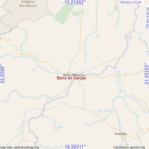
Barra do Garças GPS coordinates[2]
15° 53' 24" South, 52° 15' 24.012" West
| Map corner | latitude | longitude |
|---|---|---|
| Upper-left | -15.21262°, | -52.9598° |
| Center: | -15.89°, | -52.25667° |
| Lower-right: | -16.56511°, | -51.55355° |
| Map W x H: | 150.4×150.4 km | = 93.5×93.5mi |
| max Lat: | 2.81972° ⇑46.3% North |
| Barra do Garças: | -15.89° |
| min Lat: | ⇓53.7% South -33.69111° |
| min Long | Barra do Garça | max Long |
| -72.89583° | -52.25667° | -32.41083° |
| W 11.5%⇐ | ⇒88.5% E |
Elevation
Elevation of Barra do Garças is 302 m = 991 ft, and this is 78.9 m = 259 ft below average elevation for this country.
| Max E: |
1603 m = 5259 ft | 52.9% |
| Avg. | 380.9 m = 1250 ft | |
| Barra do Garças | 302 m = 991 ft | |
Min E: |
0 m = 0 ft | 47.1% |
See also: Barra do Garças elevation on elevation.city.
Geographical zone
Barra do Garças is located in South Torrid zone (between Equator and Tropic of Capricorn). Distance of this Southern Tropic circle is 839.1 km =521.4 mi to South.| Distance of | km | miles | from Barra do Garças |
|---|---|---|---|
| Equator | 1766.8 | 1097.8 | to North |
| Tropic Capricorn | 839.1 | 521.4 | to South |
| Antarctic Circle | 5634.4 | 3501.1 | to South |
| South Pole | 8240.3 | 5120.3 | to South |


Nearby cities:
15 places around Barra do Garças: (largest is in red/bold)
• Alto Araguaia
188.5 km =117.1 mi,  212°
212°
• Aragarças
1 km =0.6 mi,  143°
143°
• Araguaiana
48.7 km =30.3 mi,  69°
69°
• Caiapônia
127.8 km =79.4 mi,  158°
158°
• Firminópolis
222.1 km =138 mi,  110°
110°
• Guiratinga
168.6 km =104.8 mi,  252°
252°
• Iporá
136.2 km =84.6 mi,  116°
116°
• Itapirapuã
175.9 km =109.3 mi,  87°
87°
• Mineiros
189.3 km =117.6 mi,  189°
189°
• Mozarlândia
221.2 km =137.4 mi,  54°
54°
• Nova Xavantina
136.7 km =84.9 mi,  355°
355°
• Paraúna
225.9 km =140.4 mi, 121°
• Piranhas
75.6 km =47 mi, 142°
• Portelândia
168.8 km =104.9 mi,  195°
195°
• São Luís de Montes Belos
213.2 km =132.5 mi, 109°
Sources, notices
• [Note1] Compared only with cities in Brazil existing in our database
• [Src1] Map data: © OpenStreetMap contributors (CC-BY-SA)
• [Src2] Other city data from geonames.org with taken over terms of usage.
• [Src3] Geographical zone / Annual Mean Temperature by Robert A. Rohde @ Wikipedia
