Nova Prata geodata
Nova Prata (Rio Grande do Sul) is a populated place; located in Brazil in America/Sao_Paulo (GMT-3) time zone. With population of 17,943 people, there are 1047 cities with bigger population in this country. Compared to other cities in Brazil, 95.6% of cities are located further ↑North; 85.9% of cities are located further →East and 77.4% of cities have lower elevation than Nova Prata. Note1


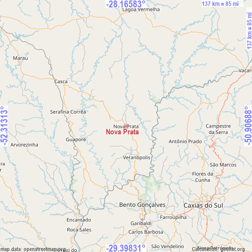
Nova Prata GPS coordinates[2]
28° 47' 2.004" South, 51° 36' 36" West
| Map corner | latitude | longitude |
|---|---|---|
| Upper-left | -28.16583°, | -52.31313° |
| Center: | -28.78389°, | -51.61° |
| Lower-right: | -29.39831°, | -50.90688° |
| Map W x H: | 137×137 km | = 85.1×85.1mi |
| max Lat: | 2.81972° ⇑95.6% North |
| Nova Prata: | -28.78389° |
| min Lat: | ⇓4.4% South -33.69111° |
| min Long | Nova Prata | max Long |
| -72.89583° | -51.61° | -32.41083° |
| W 14.1%⇐ | ⇒85.9% E |
Elevation
Elevation of Nova Prata is 658 m = 2159 ft, and this is 277.1 m = 909 ft above average elevation for this country.
| Max E: |
1603 m = 5259 ft | 22.6% |
| Nova Prata | 658 m 2159 ft | |
| Avg. | 380.9 m = 1250 ft | |
Min E: |
0 m = 0 ft | 77.4% |
See also: Brazil elevation on elevation.city.
Geographical zone
Nova Prata is located in South temperate zone (between Tropic of Capricorn and the Antarctic Circle). Distance of this Southern Tropic circle is 594.5 km =369.4 mi to North.| Distance of | km | miles | from Nova Prata |
|---|---|---|---|
| Equator | 3200.5 | 1988.7 | to North |
| Tropic Capricorn | 594.5 | 369.4 | to North |
| Antarctic Circle | 4200.7 | 2610.2 | to South |
| South Pole | 6806.6 | 4229.4 | to South |


Nearby cities:
15 places around Nova Prata: (largest is in red/bold)
• Arroio do Meio
76 km =47.2 mi,  205°
205°
• Bento Gonçalves
44 km =27.3 mi,  168°
168°
• Carlos Barbosa
58 km =36 mi, 169°
• Caxias do Sul
59.8 km =37.2 mi,  135°
135°
• Encantado
56.3 km =35 mi, 206°
• Farroupilha
55.3 km =34.4 mi,  152°
152°
• Flores da Cunha
49.8 km =30.9 mi,  123°
123°
• Garibaldi
53 km =32.9 mi, 171°
• Guaporé
28.2 km =17.5 mi,  255°
255°
• Lagoa Vermelha
64.5 km =40.1 mi,  7°
7°
• Marau
68.6 km =42.6 mi,  302°
302°
• São Marcos
56.7 km =35.2 mi,  111°
111°
• Teutônia
76.3 km =47.4 mi,  194°
194°
• Vacaria
72.6 km =45.1 mi,  65°
65°
• Veranópolis
17.9 km =11.1 mi,  160°
160°
Sources, notices
• [Note1] Compared only with cities in Brazil existing in our database
• [Src1] Map data: © OpenStreetMap contributors (CC-BY-SA)
• [Src2] Other city data from geonames.org with taken over terms of usage.
• [Src3] Geographical zone / Annual Mean Temperature by Robert A. Rohde @ Wikipedia
