Concórdia geodata
Concórdia (Santa Catarina) is a populated place; located in Brazil in America/Sao_Paulo (GMT-3) time zone. With population of 55,367 people, there are 396 cities with bigger population in this country. Compared to other cities in Brazil, 91.7% of cities are located further ↑North; 87.9% of cities are located further →East and 71.9% of cities have lower elevation than Concórdia. Note1


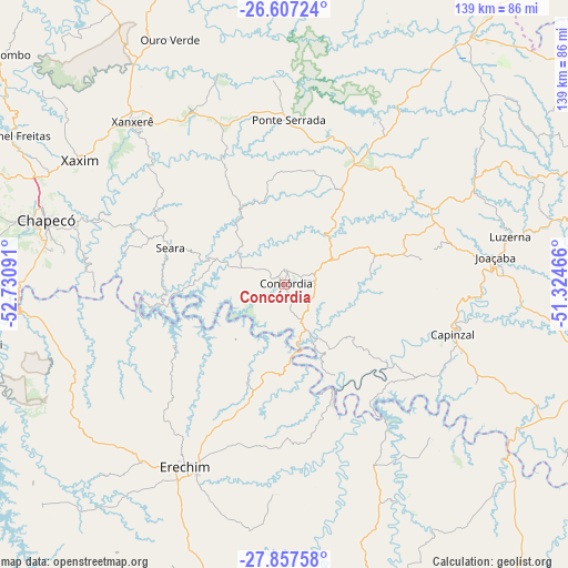
Concórdia GPS coordinates[2]
27° 14' 3.012" South, 52° 1' 40.008" West
| Map corner | latitude | longitude |
|---|---|---|
| Upper-left | -26.60724°, | -52.73091° |
| Center: | -27.23417°, | -52.02778° |
| Lower-right: | -27.85758°, | -51.32466° |
| Map W x H: | 139×139 km | = 86.4×86.4mi |
| max Lat: | 2.81972° ⇑91.7% North |
| Concórdia: | -27.23417° |
| min Lat: | ⇓8.3% South -33.69111° |
| min Long | Concórdia | max Long |
| -72.89583° | -52.02778° | -32.41083° |
| W 12.1%⇐ | ⇒87.9% E |
Elevation
Elevation of Concórdia is 592 m = 1942 ft, and this is 211.1 m = 693 ft above average elevation for this country.
| Max E: |
1603 m = 5259 ft | 28.1% |
| Concórdia | 592 m 1942 ft | |
| Avg. | 380.9 m = 1250 ft | |
Min E: |
0 m = 0 ft | 71.9% |
See also: Concórdia elevation on elevation.city.
Geographical zone
Concórdia is located in South temperate zone (between Tropic of Capricorn and the Antarctic Circle). Distance of this Southern Tropic circle is 422.2 km =262.3 mi to North.| Distance of | km | miles | from Concórdia |
|---|---|---|---|
| Equator | 3028.2 | 1881.6 | to North |
| Tropic Capricorn | 422.2 | 262.3 | to North |
| Antarctic Circle | 4373 | 2717.3 | to South |
| South Pole | 6978.9 | 4336.5 | to South |


Nearby cities:
15 places around Concórdia: (largest is in red/bold)
• Campos Novos
81.5 km =50.6 mi,  103°
103°
• Capinzal
42.9 km =26.7 mi,  106°
106°
• Caçador
112.6 km =70 mi,  63°
63°
• Celso Ramos
81.5 km =50.6 mi,  123°
123°
• Chapecó
60.4 km =37.5 mi,  284°
284°
• Clevelândia
103.1 km =64.1 mi,  334°
334°
• Erechim
50.8 km =31.6 mi,  208°
208°
• Joaçaba
52.1 km =32.4 mi,  83°
83°
• Lagoa Vermelha
119.1 km =74 mi,  155°
155°
• Palmas
83.5 km =51.9 mi,  2°
2°
• Sananduva
82.5 km =51.3 mi, 164°
• Sarandi
118.4 km =73.6 mi,  228°
228°
• Tapejara
92.7 km =57.6 mi,  179°
179°
• Videira
90.3 km =56.1 mi,  73°
73°
• Xanxerê
54.5 km =33.9 mi,  316°
316°
Sources, notices
• [Note1] Compared only with cities in Brazil existing in our database
• [Src1] Map data: © OpenStreetMap contributors (CC-BY-SA)
• [Src2] Other city data from geonames.org with taken over terms of usage.
• [Src3] Geographical zone / Annual Mean Temperature by Robert A. Rohde @ Wikipedia
