Sananduva geodata
Sananduva (Rio Grande do Sul) is a populated place; located in Brazil in America/Sao_Paulo (GMT-3) time zone. With population of 9,601 people, there are 1680 cities with bigger population in this country. Compared to other cities in Brazil, 93.9% of cities are located further ↑North; 86.8% of cities are located further →East and 77.1% of cities have lower elevation than Sananduva. Note1


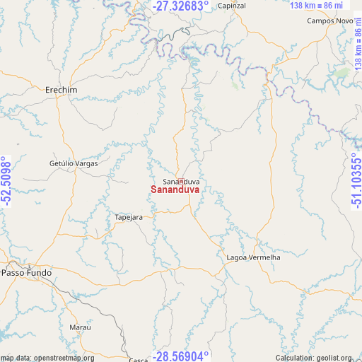
Sananduva GPS coordinates[2]
27° 56' 58.992" South, 51° 48' 24.012" West
| Map corner | latitude | longitude |
|---|---|---|
| Upper-left | -27.32683°, | -52.5098° |
| Center: | -27.94972°, | -51.80667° |
| Lower-right: | -28.56904°, | -51.10355° |
| Map W x H: | 138.1×138.1 km | = 85.8×85.8mi |
| max Lat: | 2.81972° ⇑93.9% North |
| Sananduva: | -27.94972° |
| min Lat: | ⇓6.1% South -33.69111° |
| min Long | Sananduva | max Long |
| -72.89583° | -51.80667° | -32.41083° |
| W 13.2%⇐ | ⇒86.8% E |
Elevation
Elevation of Sananduva is 655 m = 2149 ft, and this is 274.1 m = 899 ft above average elevation for this country.
| Max E: |
1603 m = 5259 ft | 22.9% |
| Sananduva | 655 m 2149 ft | |
| Avg. | 380.9 m = 1250 ft | |
Min E: |
0 m = 0 ft | 77.1% |
See also: Brazil elevation on elevation.city.
Geographical zone
Sananduva is located in South temperate zone (between Tropic of Capricorn and the Antarctic Circle). Distance of this Southern Tropic circle is 501.8 km =311.8 mi to North.| Distance of | km | miles | from Sananduva |
|---|---|---|---|
| Equator | 3107.7 | 1931 | to North |
| Tropic Capricorn | 501.8 | 311.8 | to North |
| Antarctic Circle | 4293.5 | 2667.9 | to South |
| South Pole | 6899.3 | 4287 | to South |


Nearby cities:
15 places around Sananduva: (largest is in red/bold)
• Campos Novos
83.6 km =51.9 mi,  43°
43°
• Capinzal
70.1 km =43.6 mi,  15°
15°
• Carazinho
103 km =64 mi,  248°
248°
• Celso Ramos
58 km =36 mi,  52°
52°
• Concórdia
82.5 km =51.3 mi,  344°
344°
• Erechim
57.9 km =36 mi,  307°
307°
• Estrela
86.1 km =53.5 mi,  98°
98°
• Guaporé
99.9 km =62.1 mi,  184°
184°
• Joaçaba
90.8 km =56.4 mi, 19°
• Lagoa Vermelha
39.8 km =24.7 mi,  136°
136°
• Marau
67.6 km =42 mi,  214°
214°
• Nova Prata
94.7 km =58.8 mi,  168°
168°
• Passo Fundo
68.4 km =42.5 mi,  239°
239°
• Tapejara
24.2 km =15 mi, 237°
• Vacaria
105.9 km =65.8 mi,  126°
126°
Sources, notices
• [Note1] Compared only with cities in Brazil existing in our database
• [Src1] Map data: © OpenStreetMap contributors (CC-BY-SA)
• [Src2] Other city data from geonames.org with taken over terms of usage.
• [Src3] Geographical zone / Annual Mean Temperature by Robert A. Rohde @ Wikipedia
