Caraí geodata
Caraí (Minas Gerais) is a populated place; located in Brazil in America/Sao_Paulo (GMT-3) time zone. With population of 6,750 people, there are 1843 cities with bigger population in this country. Compared to other cities in Brazil, 50.6% of cities are located further ↓South; 67.3% of cities are located further ←West and 89.6% of cities have lower elevation than Caraí. Note1


Caraí GPS coordinates[2]
17° 11' 20.004" South, 41° 41' 40.992" West
| Map corner | latitude | longitude |
|---|---|---|
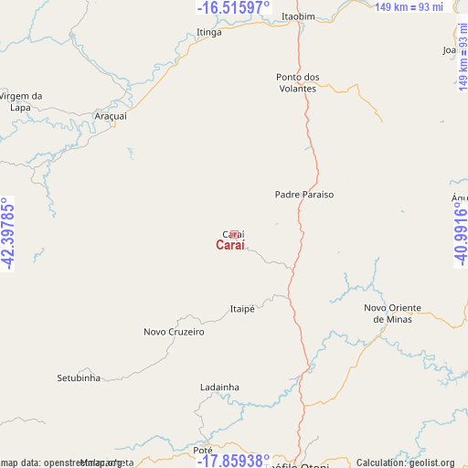
| Upper-left | -16.51597°, | -42.39785° |
| Center: | -17.18889°, | -41.69472° |
| Lower-right: | -17.85938°, | -40.9916° |
| Map W x H: | 149.4×149.4 km | = 92.8×92.8mi |
| max Lat: | 2.81972° ⇑49.4% North |
| Caraí: | -17.18889° |
| min Lat: | ⇓50.6% South -33.69111° |
| min Long | Caraí | max Long |
| -72.89583° | -41.69472° | -32.41083° |
| W 67.3%⇐ | ⇒32.7% E |
Elevation
Elevation of Caraí is 804 m = 2638 ft, and this is 423.1 m = 1388 ft above average elevation for this country.
| Max E: |
1603 m = 5259 ft | 10.4% |
| Caraí | 804 m 2638 ft | |
| Avg. | 380.9 m = 1250 ft | |
Min E: |
0 m = 0 ft | 89.6% |
See also: Brazil elevation on elevation.city.
Geographical zone
Caraí is located in South Torrid zone (between Equator and Tropic of Capricorn). Distance of this Southern Tropic circle is 694.7 km =431.7 mi to South.| Distance of | km | miles | from Caraí |
|---|---|---|---|
| Equator | 1911.2 | 1187.6 | to North |
| Tropic Capricorn | 694.7 | 431.7 | to South |
| Antarctic Circle | 5489.9 | 3411.3 | to South |
| South Pole | 8095.8 | 5030.5 | to South |


Nearby cities:
15 places around Caraí: (largest is in red/bold)
• Araçuaí
54.9 km =34.1 mi,  313°
313°
• Capelinha
103.5 km =64.3 mi,  237°
237°
• Carlos Chagas
113.9 km =70.8 mi,  120°
120°
• Itambacuri
93.7 km =58.2 mi,  179°
179°
• Itinga
64.5 km =40.1 mi,  353°
353°
• Jequitinhonha
111.6 km =69.3 mi,  41°
41°
• Joaíma
92.3 km =57.4 mi,  49°
49°
• Malacacheta
83.2 km =51.7 mi,  209°
209°
• Medina
109.9 km =68.3 mi,  12°
12°
• Minas Novas
95.2 km =59.2 mi,  268°
268°
• Novo Cruzeiro
36.5 km =22.7 mi, 211°
• Padre Paraíso
25.7 km =16 mi,  60°
60°
• Teófilo Otoni
77 km =47.8 mi,  164°
164°
• Turmalina
110.5 km =68.7 mi,  264°
264°
• Águas Formosas
81.5 km =50.6 mi,  81°
81°
Sources, notices
• [Note1] Compared only with cities in Brazil existing in our database
• [Src1] Map data: © OpenStreetMap contributors (CC-BY-SA)
• [Src2] Other city data from geonames.org with taken over terms of usage.
• [Src3] Geographical zone / Annual Mean Temperature by Robert A. Rohde @ Wikipedia
