Mathathane geodata
Mathathane (Central) is a populated place; located in Botswana in Africa/Gaborone (GMT+2) time zone. With population of 1,987 people, there are 56 cities with bigger population in this country. Compared to other cities in Botswana, 69.5% of cities are located further ↓South; 100% of cities are located further ←West and 100% of cities have higher elevation than Mathathane. Note1


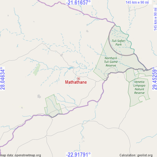
Mathathane GPS coordinates[2]
22° 16' 7.5" South, 28° 44' 58.056" East
| Map corner | latitude | longitude |
|---|---|---|
| Upper-left | -21.61657°, | 28.04634° |
| Center: | -22.26875°, | 28.74946° |
| Lower-right: | -22.91791°, | 29.45259° |
| Map W x H: | 144.7×144.7 km | = 89.9×89.9mi |
| max Lat: | -17.80165° ⇑30.5% North |
| Mathathane: | -22.26875° |
| min Lat: | ⇓69.5% South -26.9° |
| min Long | Mathathane | max Long |
| 20.06667° | 28.74946° | 28.74946° |
| W 100%⇐ | ⇒0% E |
Elevation
Elevation of Mathathane is 676 m = 2218 ft, and this is 339 m = 1112 ft below average elevation for this country.
| Max E: |
1406 m = 4613 ft | 100% |
| Avg. | 1015 m = 3330 ft | |
| Mathathane | 676 m = 2218 ft | |
Min E: |
676 m = 2218 ft | 0% |
See also: Botswana elevation on elevation.city.
Geographical zone
Mathathane is located in South Torrid zone (between Equator and Tropic of Capricorn). Distance of this Southern Tropic circle is 129.9 km =80.7 mi to South.| Distance of | km | miles | from Mathathane |
|---|---|---|---|
| Equator | 2476.1 | 1538.6 | to North |
| Tropic Capricorn | 129.9 | 80.7 | to South |
| Antarctic Circle | 4925.1 | 3060.3 | to South |
| South Pole | 7531 | 4679.5 | to South |


Nearby cities:
15 places around Mathathane: (largest is in red/bold)
• Gobojango
48.5 km =30.1 mi,  357°
357°
• Maapi
153.7 km =95.5 mi,  249°
249°
• Makobeng
137.4 km =85.4 mi,  233°
233°
• Malaka
150.9 km =93.8 mi,  255°
255°
• Mathakola
156.1 km =97 mi, 251°
• Maunatlala
120.7 km =75 mi, 252°
• Mogapi
94.3 km =58.6 mi,  266°
266°
• Mogapinyana
118.7 km =73.8 mi, 264°
• Moremi
137.7 km =85.6 mi, 255°
• Ramokgonami
151.4 km =94.1 mi,  244°
244°
• Ratholo
131.1 km =81.5 mi, 247°
• Sefophe
81.1 km =50.4 mi,  276°
276°
• Selebi-Phikwe
98.8 km =61.4 mi,  289°
289°
• Tamasane
139.6 km =86.7 mi, 263°
• Tobane
94.4 km =58.7 mi, 292°
Sources, notices
• [Note1] Compared only with cities in Botswana existing in our database
• [Src1] Map data: © OpenStreetMap contributors (CC-BY-SA)
• [Src2] Other city data from geonames.org with taken over terms of usage.
• [Src3] Geographical zone / Annual Mean Temperature by Robert A. Rohde @ Wikipedia
