Havre-Saint-Pierre geodata
Havre-Saint-Pierre (Quebec) is a populated place; located in Canada in America/Toronto (GMT-4) time zone. With population of 2,966 people, there are 615 cities with bigger population in this country. Compared to other cities in Canada, 77.6% of cities are located further ↓South; 94.7% of cities are located further ←West and 91.9% of cities have higher elevation than Havre-Saint-Pierre. Note1


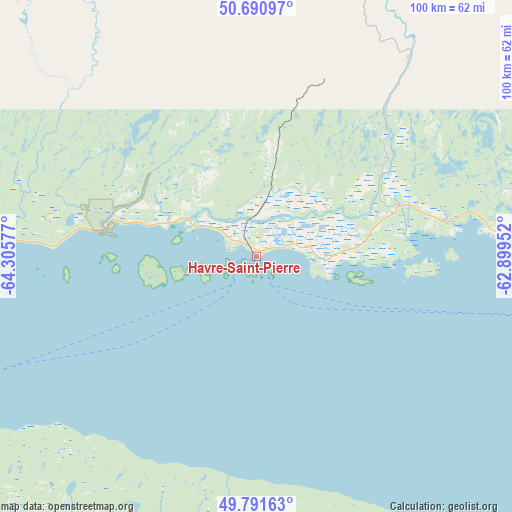
Havre-Saint-Pierre GPS coordinates[2]
50° 14' 36.312" North, 63° 36' 9.504" West
| Map corner | latitude | longitude |
|---|---|---|
| Upper-left | 50.69097°, | -64.30577° |
| Center: | 50.24342°, | -63.60264° |
| Lower-right: | 49.79163°, | -62.89952° |
| Map W x H: | 100×100 km | = 62.1×62.1mi |
| max Lat: | 73.03752° ⇑22.4% North |
| Havre-Saint-Pierre: | 50.24342° |
| min Lat: | ⇓77.6% South 42.05009° |
| min Long | Havre-Saint-Pie | max Long |
| -139.43328° | -63.60264° | -52.70931° |
| W 94.7%⇐ | ⇒5.3% E |
Elevation
Elevation of Havre-Saint-Pierre is 12 m = 39 ft, and this is 242.4 m = 795 ft below average elevation for this country.
| Max E: |
1518 m = 4980 ft | 91.9% |
| Avg. | 254.4 m = 835 ft | |
| Havre-Saint-Pierre | 12 m = 39 ft | |
Min E: |
-2 m = -7 ft | 8.1% |
See also: Canada elevation on elevation.city.
Geographical zone
Havre-Saint-Pierre is located in North temperate zone (between Tropic of Cancer and the Arctic Circle). Distance of this North polar circle is 1814.6 km =1127.5 mi to North.| Distance of | km | miles | from Havre-Saint-Pierre |
|---|---|---|---|
| North Pole | 4420.5 | 2746.8 | to North |
| Arctic Circle | 1814.6 | 1127.5 | to North |
| Tropic Cancer | 2980.6 | 1852.1 | to South |
| Equator | 5586.5 | 3471.3 | to South |


Nearby cities:
15 places around Havre-Saint-Pierre: (largest is in red/bold)
• Bonaventure
280.3 km =174.2 mi,  209°
209°
• Cap-Chat
255.4 km =158.7 mi,  240°
240°
• Chandler
224.6 km =139.6 mi,  200°
200°
• Gaspé
169.1 km =105.1 mi, 202°
• Maisonnette
287.6 km =178.7 mi, 200°
• Maliotenam
183.5 km =114 mi,  268°
268°
• Miscou
265.2 km =164.8 mi, 195°
• Murdochville
197.8 km =122.9 mi,  223°
223°
• New Carlisle
278.6 km =173.1 mi, 206°
• New-Richmond
283.7 km =176.3 mi, 215°
• Port-Cartier
233.7 km =145.2 mi,  264°
264°
• Saint-Alexandre
233.5 km =145.1 mi, 264°
• Sainte-Anne-des-Monts
242.3 km =150.6 mi, 239°
• Sainte-Cécile
276.6 km =171.9 mi, 196°
• Sept-Îles
197.8 km =122.9 mi, 268°
Sources, notices
• [Note1] Compared only with cities in Canada existing in our database
• [Src1] Map data: © OpenStreetMap contributors (CC-BY-SA)
• [Src2] Other city data from geonames.org with taken over terms of usage.
• [Src3] Geographical zone / Annual Mean Temperature by Robert A. Rohde @ Wikipedia
