Rayside-Balfour geodata
Rayside-Balfour (Ontario) is a populated place; located in Canada in America/Toronto (GMT-4) time zone. With population of 16,050 people, there are 226 cities with bigger population in this country. Compared to other cities in Canada, 54.8% of cities are located further ↑North; 59.8% of cities are located further →East and 68% of cities have lower elevation than Rayside-Balfour. Note1


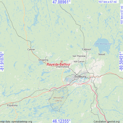
Rayside-Balfour GPS coordinates[2]
46° 36' 31.428" North, 81° 12' 27.468" West
| Map corner | latitude | longitude |
|---|---|---|
| Upper-left | 47.08961°, | -81.91076° |
| Center: | 46.60873°, | -81.20763° |
| Lower-right: | 46.12355°, | -80.50451° |
| Map W x H: | 107.4×107.4 km | = 66.7×66.7mi |
| max Lat: | 73.03752° ⇑54.8% North |
| Rayside-Balfour: | 46.60873° |
| min Lat: | ⇓45.2% South 42.05009° |
| min Long | Rayside-Balfour | max Long |
| -139.43328° | -81.20763° | -52.70931° |
| W 40.2%⇐ | ⇒59.8% E |
Elevation
Elevation of Rayside-Balfour is 280 m = 919 ft, and this is 25.6 m = 84 ft above average elevation for this country.
| Max E: |
1518 m = 4980 ft | 32% |
| Rayside-Balfour | 280 m 919 ft | |
| Avg. | 254.4 m = 835 ft | |
Min E: |
-2 m = -7 ft | 68% |
See also: Canada elevation on elevation.city.
Geographical zone
Rayside-Balfour is located in North temperate zone (between Tropic of Cancer and the Arctic Circle). Distance of this North polar circle is 2218.8 km =1378.7 mi to North.| Distance of | km | miles | from Rayside-Balfour |
|---|---|---|---|
| North Pole | 4824.7 | 2997.9 | to North |
| Arctic Circle | 2218.8 | 1378.7 | to North |
| Tropic Cancer | 2576.5 | 1601 | to South |
| Equator | 5182.4 | 3220.2 | to South |


Nearby cities:
15 places around Rayside-Balfour: (largest is in red/bold)
• Azilda
10.5 km =6.5 mi,  128°
128°
• Cache Bay
97.5 km =60.6 mi,  106°
106°
• Capreol
24.4 km =15.2 mi,  63°
63°
• Dowling
10.2 km =6.3 mi,  258°
258°
• Elliot Lake
112 km =69.6 mi, 257°
• Espanola
57.9 km =36 mi,  227°
227°
• Greater Sudbury
21.2 km =13.2 mi, 128°
• Little Current
89.1 km =55.4 mi,  218°
218°
• Lively
20 km =12.4 mi,  167°
167°
• North Bay
137.3 km =85.3 mi,  103°
103°
• Powassan
156.4 km =97.2 mi, 114°
• Spanish
98.7 km =61.3 mi,  242°
242°
• Temiskaming Shores
149.9 km =93.1 mi,  48°
48°
• Tobermory
155.2 km =96.4 mi,  193°
193°
• Valley East
17.1 km =10.6 mi,  67°
67°
Sources, notices
• [Note1] Compared only with cities in Canada existing in our database
• [Src1] Map data: © OpenStreetMap contributors (CC-BY-SA)
• [Src2] Other city data from geonames.org with taken over terms of usage.
• [Src3] Geographical zone / Annual Mean Temperature by Robert A. Rohde @ Wikipedia
