Saint-Augustin geodata
Saint-Augustin (Quebec) is a populated place; located in Canada in America/Blanc-Sablon (GMT-4) time zone. With population of 3,961 people, there are 536 cities with bigger population in this country. Compared to other cities in Canada, 83.3% of cities are located further ↓South; 97.1% of cities are located further ←West and 96% of cities have higher elevation than Saint-Augustin. Note1


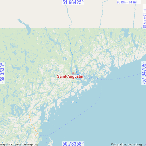
Saint-Augustin GPS coordinates[2]
51° 13' 33.672" North, 58° 39' 0.612" West
| Map corner | latitude | longitude |
|---|---|---|
| Upper-left | 51.66425°, | -59.3533° |
| Center: | 51.22602°, | -58.65017° |
| Lower-right: | 50.78358°, | -57.94705° |
| Map W x H: | 97.9×97.9 km | = 60.8×60.8mi |
| max Lat: | 73.03752° ⇑16.7% North |
| Saint-Augustin: | 51.22602° |
| min Lat: | ⇓83.3% South 42.05009° |
| min Long | Saint-Augustin | max Long |
| -139.43328° | -58.65017° | -52.70931° |
| W 97.1%⇐ | ⇒2.9% E |
Elevation
Elevation of Saint-Augustin is 7 m = 23 ft, and this is 247.4 m = 812 ft below average elevation for this country.
| Max E: |
1518 m = 4980 ft | 96% |
| Avg. | 254.4 m = 835 ft | |
| Saint-Augustin | 7 m = 23 ft | |
Min E: |
-2 m = -7 ft | 4% |
See also: Canada elevation on elevation.city.
Geographical zone
Saint-Augustin is located in North temperate zone (between Tropic of Cancer and the Arctic Circle). Distance of this North polar circle is 1705.4 km =1059.7 mi to North.| Distance of | km | miles | from Saint-Augustin |
|---|---|---|---|
| North Pole | 4311.3 | 2678.9 | to North |
| Arctic Circle | 1705.4 | 1059.7 | to North |
| Tropic Cancer | 3089.9 | 1920 | to South |
| Equator | 5695.8 | 3539.2 | to South |


Nearby cities:
14 places around Saint-Augustin: (largest is in red/bold)
• Bay St. George South
333.7 km =207.4 mi,  182°
182°
• Botwood
329.4 km =204.7 mi,  134°
134°
• Burgeo
408.2 km =253.6 mi,  169°
169°
• Channel-Port aux Basques
407.7 km =253.3 mi, 184°
• Corner Brook
257.9 km =160.3 mi, 168°
• Deer Lake
244.8 km =152.1 mi,  159°
159°
• Grand Falls-Windsor
332.2 km =206.4 mi,  140°
140°
• Happy Valley-Goose Bay
257.6 km =160.1 mi,  333°
333°
• La Scie
257.9 km =160.3 mi,  123°
123°
• Pasadena
256.8 km =159.6 mi, 163°
• Springdale
265.4 km =164.9 mi, 136°
• St. Anthony
212.8 km =132.2 mi,  85°
85°
• Stephenville
297.6 km =184.9 mi, 179°
• Stephenville Crossing
303.5 km =188.6 mi, 177°
Sources, notices
• [Note1] Compared only with cities in Canada existing in our database
• [Src1] Map data: © OpenStreetMap contributors (CC-BY-SA)
• [Src2] Other city data from geonames.org with taken over terms of usage.
• [Src3] Geographical zone / Annual Mean Temperature by Robert A. Rohde @ Wikipedia
