Saint-Boniface geodata
Saint-Boniface (Quebec) is a populated place; located in Canada in America/Toronto (GMT-4) time zone. With population of 1,035 people, there are 1031 cities with bigger population in this country. Compared to other cities in Canada, 55.5% of cities are located further ↑North; 54.9% of cities are located further ←West and 62.3% of cities have lower elevation than Saint-Boniface. Note1


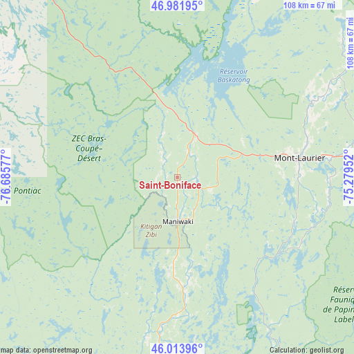
Saint-Boniface GPS coordinates[2]
46° 30' 0.396" North, 75° 58' 57.504" West
| Map corner | latitude | longitude |
|---|---|---|
| Upper-left | 46.98195°, | -76.68577° |
| Center: | 46.50011°, | -75.98264° |
| Lower-right: | 46.01396°, | -75.27952° |
| Map W x H: | 107.6×107.6 km | = 66.9×66.9mi |
| max Lat: | 73.03752° ⇑55.5% North |
| Saint-Boniface: | 46.50011° |
| min Lat: | ⇓44.5% South 42.05009° |
| min Long | Saint-Boniface | max Long |
| -139.43328° | -75.98264° | -52.70931° |
| W 54.9%⇐ | ⇒45.1% E |
Elevation
Elevation of Saint-Boniface is 241 m = 791 ft, and this is 13.4 m = 44 ft below average elevation for this country.
| Max E: |
1518 m = 4980 ft | 37.7% |
| Avg. | 254.4 m = 835 ft | |
| Saint-Boniface | 241 m = 791 ft | |
Min E: |
-2 m = -7 ft | 62.3% |
See also: Canada elevation on elevation.city.
Geographical zone
Saint-Boniface is located in North temperate zone (between Tropic of Cancer and the Arctic Circle). Distance of this North polar circle is 2230.8 km =1386.2 mi to North.| Distance of | km | miles | from Saint-Boniface |
|---|---|---|---|
| North Pole | 4836.7 | 3005.4 | to North |
| Arctic Circle | 2230.8 | 1386.2 | to North |
| Tropic Cancer | 2564.4 | 1593.4 | to South |
| Equator | 5170.3 | 3212.7 | to South |


Nearby cities:
15 places around Saint-Boniface: (largest is in red/bold)
• Cantley
104.9 km =65.2 mi,  171°
171°
• Ferme-Neuve
46.4 km =28.8 mi,  61°
61°
• Fort-Coulonge
92.5 km =57.5 mi,  218°
218°
• Kazabazua
61.2 km =38 mi,  182°
182°
• La Minerve
85.2 km =52.9 mi,  109°
109°
• Labelle
98.9 km =61.5 mi,  104°
104°
• Lac-Simon
102.7 km =63.8 mi, 111°
• Maniwaki
13 km =8.1 mi, 174°
• Mont-Laurier
37.4 km =23.2 mi,  81°
81°
• Notre-Dame-du-Mont-Carmel
87.6 km =54.4 mi,  127°
127°
• Rivière-Rouge
86 km =53.4 mi, 96°
• Saint-Raphaël
27.9 km =17.3 mi,  185°
185°
• Saint-Émile-de-Suffolk
103.5 km =64.3 mi, 127°
• Val-des-Monts
97.6 km =60.6 mi, 165°
• Wakefield
93.4 km =58 mi, 172°
Sources, notices
• [Note1] Compared only with cities in Canada existing in our database
• [Src1] Map data: © OpenStreetMap contributors (CC-BY-SA)
• [Src2] Other city data from geonames.org with taken over terms of usage.
• [Src3] Geographical zone / Annual Mean Temperature by Robert A. Rohde @ Wikipedia
