Fogo Island geodata
Fogo Island (Newfoundland and Labrador) is a populated place; located in Canada in America/St_Johns (GMT-2.5) time zone. With population of 2,244 people, there are 710 cities with bigger population in this country. Compared to other cities in Canada, 72.7% of cities are located further ↓South; 98.7% of cities are located further ←West and 98.5% of cities have higher elevation than Fogo Island. Note1


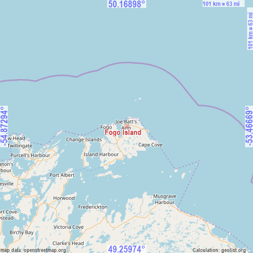
Fogo Island GPS coordinates[2]
49° 42' 59.364" North, 54° 10' 11.316" West
| Map corner | latitude | longitude |
|---|---|---|
| Upper-left | 50.16898°, | -54.87294° |
| Center: | 49.71649°, | -54.16981° |
| Lower-right: | 49.25974°, | -53.46669° |
| Map W x H: | 101.1×101.1 km | = 62.8×62.8mi |
| max Lat: | 73.03752° ⇑27.3% North |
| Fogo Island: | 49.71649° |
| min Lat: | ⇓72.7% South 42.05009° |
| min Long | Fogo Island | max Long |
| -139.43328° | -54.16981° | -52.70931° |
| W 98.7%⇐ | ⇒1.3% E |
Elevation
Elevation of Fogo Island is 2 m = 7 ft, and this is 252.4 m = 828 ft below average elevation for this country.
| Max E: |
1518 m = 4980 ft | 98.5% |
| Avg. | 254.4 m = 835 ft | |
| Fogo Island | 2 m = 7 ft | |
Min E: |
-2 m = -7 ft | 1.5% |
See also: Canada elevation on elevation.city.
Geographical zone
Fogo Island is located in North temperate zone (between Tropic of Cancer and the Arctic Circle). Distance of this North polar circle is 1873.2 km =1164 mi to North.| Distance of | km | miles | from Fogo Island |
|---|---|---|---|
| North Pole | 4479.1 | 2783.2 | to North |
| Arctic Circle | 1873.2 | 1164 | to North |
| Tropic Cancer | 2922 | 1815.6 | to South |
| Equator | 5528 | 3434.9 | to South |


Nearby cities:
15 places around Fogo Island: (largest is in red/bold)
• Bloomfield
149.6 km =93 mi,  172°
172°
• Bonavista
141.2 km =87.7 mi,  147°
147°
• Botwood
106 km =65.9 mi,  233°
233°
• Carbonear
231.4 km =143.8 mi,  162°
162°
• Catalina
155.2 km =96.4 mi, 149°
• Clarenville-Shoal Harbour
171.4 km =106.5 mi,  175°
175°
• Gambo
103.8 km =64.5 mi, 181°
• Gander Bay North
46.5 km =28.9 mi,  208°
208°
• Grand Falls-Windsor
139 km =86.4 mi, 231°
• Hare Bay
97 km =60.3 mi, 173°
• La Scie
105.7 km =65.7 mi,  284°
284°
• Lewisporte
82 km =51 mi, 230°
• Springdale
138.6 km =86.1 mi,  259°
259°
• St. Anthony
209.7 km =130.3 mi,  331°
331°
• Virgin Arm-Carter's Cove
48.5 km =30.1 mi,  245°
245°
Sources, notices
• [Note1] Compared only with cities in Canada existing in our database
• [Src1] Map data: © OpenStreetMap contributors (CC-BY-SA)
• [Src2] Other city data from geonames.org with taken over terms of usage.
• [Src3] Geographical zone / Annual Mean Temperature by Robert A. Rohde @ Wikipedia
