Sake geodata
Sake (Nord Kivu) is a populated place; located in Democratic Republic of the Congo in Africa/Lubumbashi (GMT+2) time zone. With population of 17,151 people, there are 67 cities with bigger population in this country. Compared to other cities in Democratic Republic of the Congo, 67.1% of cities are located further ↓South; 90% of cities are located further ←West and 92.9% of cities have lower elevation than Sake. Note1


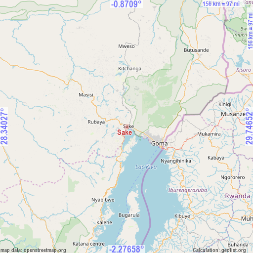
Sake GPS coordinates[2]
1° 34' 25.896" South, 29° 2' 36.204" East
| Map corner | latitude | longitude |
|---|---|---|
| Upper-left | -0.8709°, | 28.34027° |
| Center: | -1.57386°, | 29.04339° |
| Lower-right: | -2.27658°, | 29.74652° |
| Map W x H: | 156.3×156.3 km | = 97.1×97.1mi |
| max Lat: | 4.279° ⇑32.9% North |
| Sake: | -1.57386° |
| min Lat: | ⇓67.1% South -11.76097° |
| min Long | Sake | max Long |
| 12.37148° | 29.04339° | 30.25224° |
| W 90%⇐ | ⇒10% E |
Elevation
Elevation of Sake is 1468 m = 4816 ft, and this is 812 m = 2664 ft above average elevation for this country.
| Max E: |
1996 m = 6549 ft | 7.1% |
| Sake | 1468 m 4816 ft | |
| Avg. | 656 m = 2152 ft | |
Min E: |
11 m = 36 ft | 92.9% |
See also: Democratic Republic of the Congo elevation on elevation.city.
Geographical zone
Sake is located in South Torrid zone (between Equator and Tropic of Capricorn). Distance of Equator is 175 km =108.7 mi to North.| Distance of | km | miles | from Sake |
|---|---|---|---|
| Equator | 175 | 108.7 | to North |
| Tropic Capricorn | 2430.9 | 1510.5 | to South |
| Antarctic Circle | 7226.2 | 4490.2 | to South |
| South Pole | 9832.1 | 6109.4 | to South |


Nearby cities:
11 places around Sake: (largest is in red/bold)
• Beni
234.5 km =145.7 mi,  11°
11°
• Bukavu
104.4 km =64.9 mi,  192°
192°
• Bunia
373.4 km =232 mi,  21°
21°
• Butembo
192.7 km =119.7 mi, 8°
• Goma
23.4 km =14.5 mi,  118°
118°
• Kabare
106.4 km =66.1 mi,  195°
195°
• Kampene
346.8 km =215.5 mi,  229°
229°
• Kasongo
412.7 km =256.4 mi,  219°
219°
• Kindu
378.7 km =235.3 mi,  246°
246°
• Uvira
202.8 km =126 mi,  177°
177°
• Wamba
430 km =267.2 mi,  344°
344°
Sources, notices
• [Note1] Compared only with cities in Democratic Republic of the Congo existing in our database
• [Src1] Map data: © OpenStreetMap contributors (CC-BY-SA)
• [Src2] Other city data from geonames.org with taken over terms of usage.
• [Src3] Geographical zone / Annual Mean Temperature by Robert A. Rohde @ Wikipedia
