Kabare geodata
Kabare (South Kivu) is a populated place; located in Democratic Republic of the Congo in Africa/Lubumbashi (GMT+2) time zone. With population of 37,034 people, there are 48 cities with bigger population in this country. Compared to other cities in Democratic Republic of the Congo, 60% of cities are located further ↓South; 87.1% of cities are located further ←West and 100% of cities have lower elevation than Kabare. Note1


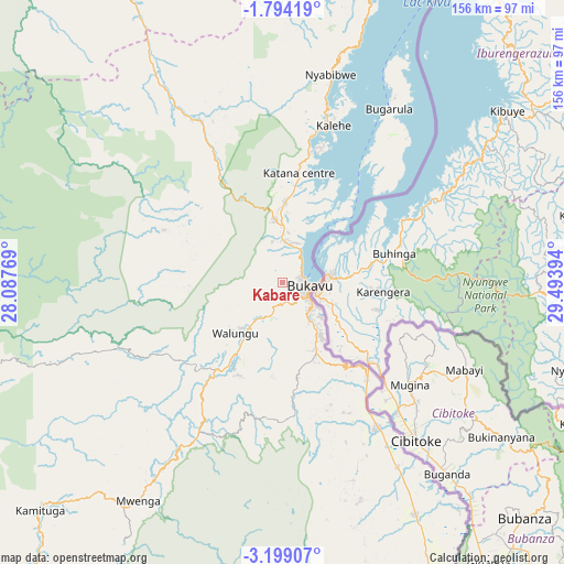
Kabare GPS coordinates[2]
2° 29' 48.552" South, 28° 47' 26.916" East
| Map corner | latitude | longitude |
|---|---|---|
| Upper-left | -1.79419°, | 28.08769° |
| Center: | -2.49682°, | 28.79081° |
| Lower-right: | -3.19907°, | 29.49394° |
| Map W x H: | 156.2×156.2 km | = 97.1×97.1mi |
| max Lat: | 4.279° ⇑40% North |
| Kabare: | -2.49682° |
| min Lat: | ⇓60% South -11.76097° |
| min Long | Kabare | max Long |
| 12.37148° | 28.79081° | 30.25224° |
| W 87.1%⇐ | ⇒12.9% E |
Elevation
Elevation of Kabare is 1996 m = 6549 ft, and this is 1340 m = 4396 ft above average elevation for this country.
| Max E: |
1996 m = 6549 ft | 0% |
| Kabare | 1996 m 6549 ft | |
| Avg. | 656 m = 2152 ft | |
Min E: |
11 m = 36 ft | 100% |
See also: Democratic Republic of the Congo elevation on elevation.city.
Geographical zone
Kabare is located in South Torrid zone (between Equator and Tropic of Capricorn). Distance of Equator is 277.6 km =172.5 mi to North.| Distance of | km | miles | from Kabare |
|---|---|---|---|
| Equator | 277.6 | 172.5 | to North |
| Tropic Capricorn | 2328.3 | 1446.7 | to South |
| Antarctic Circle | 7123.6 | 4426.4 | to South |
| South Pole | 9729.4 | 6045.6 | to South |


Nearby cities:
11 places around Kabare: (largest is in red/bold)
• Beni
340.8 km =211.8 mi,  12°
12°
• Bukavu
5.8 km =3.6 mi,  83°
83°
• Butembo
298.6 km =185.5 mi, 10°
• Goma
103.6 km =64.4 mi,  27°
27°
• Kalemie
386.3 km =240 mi,  173°
173°
• Kampene
265.6 km =165 mi,  242°
242°
• Kasongo
318.8 km =198.1 mi,  227°
227°
• Kindu
322.4 km =200.3 mi,  261°
261°
• Kongolo
377.6 km =234.6 mi,  211°
211°
• Sake
106.4 km =66.1 mi,  15°
15°
• Uvira
107.1 km =66.5 mi,  158°
158°
Sources, notices
• [Note1] Compared only with cities in Democratic Republic of the Congo existing in our database
• [Src1] Map data: © OpenStreetMap contributors (CC-BY-SA)
• [Src2] Other city data from geonames.org with taken over terms of usage.
• [Src3] Geographical zone / Annual Mean Temperature by Robert A. Rohde @ Wikipedia
