Kongolo geodata
Kongolo (Tanganyika) is a populated place; located in Democratic Republic of the Congo in Africa/Lubumbashi (GMT+2) time zone. With population of 31,943 people, there are 56 cities with bigger population in this country. Compared to other cities in Democratic Republic of the Congo, 70% of cities are located further ↑North; 80% of cities are located further ←West and 57.1% of cities have lower elevation than Kongolo. Note1


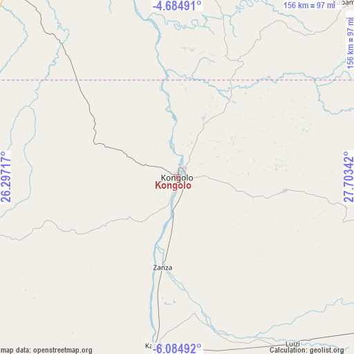
Kongolo GPS coordinates[2]
5° 23' 7.152" South, 27° 0' 1.044" East
| Map corner | latitude | longitude |
|---|---|---|
| Upper-left | -4.68491°, | 26.29717° |
| Center: | -5.38532°, | 27.00029° |
| Lower-right: | -6.08492°, | 27.70342° |
| Map W x H: | 155.7×155.7 km | = 96.7×96.7mi |
| max Lat: | 4.279° ⇑70% North |
| Kongolo: | -5.38532° |
| min Lat: | ⇓30% South -11.76097° |
| min Long | Kongolo | max Long |
| 12.37148° | 27.00029° | 30.25224° |
| W 80%⇐ | ⇒20% E |
Elevation
Elevation of Kongolo is 562 m = 1844 ft, and this is 94 m = 308 ft below average elevation for this country.
| Max E: |
1996 m = 6549 ft | 42.9% |
| Avg. | 656 m = 2152 ft | |
| Kongolo | 562 m = 1844 ft | |
Min E: |
11 m = 36 ft | 57.1% |
See also: Democratic Republic of the Congo elevation on elevation.city.
Geographical zone
Kongolo is located in South Torrid zone (between Equator and Tropic of Capricorn). Distance of Equator is 598.8 km =372.1 mi to North.| Distance of | km | miles | from Kongolo |
|---|---|---|---|
| Equator | 598.8 | 372.1 | to North |
| Tropic Capricorn | 2007.1 | 1247.2 | to South |
| Antarctic Circle | 6802.4 | 4226.8 | to South |
| South Pole | 9408.3 | 5846 | to South |


Nearby cities:
15 places around Kongolo: (largest is in red/bold)
• Bukavu
381.2 km =236.9 mi,  32°
32°
• Gandajika
369.3 km =229.5 mi,  245°
245°
• Kabalo
74.8 km =46.5 mi,  187°
187°
• Kabare
377.6 km =234.6 mi, 31°
• Kabinda
290.9 km =180.8 mi, 253°
• Kalemie
250.7 km =155.8 mi,  104°
104°
• Kampene
202.3 km =125.7 mi,  349°
349°
• Kasongo
112.7 km =70 mi,  340°
340°
• Kindu
296.6 km =184.3 mi, 336°
• Lodja
430.1 km =267.3 mi,  298°
298°
• Lubao
138.5 km =86.1 mi,  269°
269°
• Lusambo
396.4 km =246.3 mi,  276°
276°
• Mbuji-Mayi
386.4 km =240.1 mi,  257°
257°
• Mwene-Ditu
431.7 km =268.2 mi, 245°
• Uvira
324.2 km =201.4 mi,  46°
46°
Sources, notices
• [Note1] Compared only with cities in Democratic Republic of the Congo existing in our database
• [Src1] Map data: © OpenStreetMap contributors (CC-BY-SA)
• [Src2] Other city data from geonames.org with taken over terms of usage.
• [Src3] Geographical zone / Annual Mean Temperature by Robert A. Rohde @ Wikipedia
