Djambala geodata
Djambala (Plateaux) is a seat of a first-order administrative division; located in Republic of the Congo in Africa/Brazzaville (GMT+1) time zone. With population of 9,650 people, there are 14 cities with bigger population in this country. Compared to other cities in Republic of the Congo, 63.2% of cities are located further ↓South; 52.6% of cities are located further ←West and 100% of cities have lower elevation than Djambala. Note1


Djambala GPS coordinates[2]
2° 32' 40.992" South, 14° 45' 11.988" East
| Map corner | latitude | longitude |
|---|---|---|
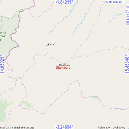
| Upper-left | -1.84211°, | 14.05021° |
| Center: | -2.54472°, | 14.75333° |
| Lower-right: | -3.24694°, | 15.45646° |
| Map W x H: | 156.2×156.2 km | = 97.1×97.1mi |
| max Lat: | 1.64806° ⇑36.8% North |
| Djambala: | -2.54472° |
| min Lat: | ⇓63.2% South -4.77609° |
| min Long | Djambala | max Long |
| 11.8125° | 14.75333° | 18.05981° |
| W 52.6%⇐ | ⇒47.4% E |
Elevation
Elevation of Djambala is 790 m = 2592 ft, and this is 471 m = 1545 ft above average elevation for this country.
| Max E: |
790 m = 2592 ft | 0% |
| Djambala | 790 m 2592 ft | |
| Avg. | 319 m = 1047 ft | |
Min E: |
7 m = 23 ft | 100% |
See also: Republic of the Congo elevation on elevation.city.
Geographical zone
Djambala is located in South Torrid zone (between Equator and Tropic of Capricorn). Distance of Equator is 282.9 km =175.8 mi to North.| Distance of | km | miles | from Djambala |
|---|---|---|---|
| Equator | 282.9 | 175.8 | to North |
| Tropic Capricorn | 2323 | 1443.4 | to South |
| Antarctic Circle | 7118.2 | 4423 | to South |
| South Pole | 9724.1 | 6042.3 | to South |


Nearby cities:
15 places around Djambala: (largest is in red/bold)
• Boukiéro
193.1 km =120 mi,  162°
162°
• Brazzaville
200.2 km =124.4 mi, 162°
• Dolisie
295.7 km =183.7 mi,  231°
231°
• Ewo
186.1 km =115.6 mi,  2°
2°
• Gamboma
144.1 km =89.5 mi,  58°
58°
• Kayes
246.2 km =153 mi,  221°
221°
• Kinkala
202 km =125.5 mi,  179°
179°
• Loandjili
404.6 km =251.4 mi, 232°
• Loango
401.7 km =249.6 mi, 234°
• Madingou
223.3 km =138.8 mi, 216°
• Makoua
300.1 km =186.5 mi,  19°
19°
• Mossendjo
232 km =144.2 mi,  258°
258°
• Nkayi
244.4 km =151.9 mi, 221°
• Owando
262.4 km =163 mi,  29°
29°
• Sibiti
200.7 km =124.7 mi, 230°
Sources, notices
• [Note1] Compared only with cities in Republic of the Congo existing in our database
• [Src1] Map data: © OpenStreetMap contributors (CC-BY-SA)
• [Src2] Other city data from geonames.org with taken over terms of usage.
• [Src3] Geographical zone / Annual Mean Temperature by Robert A. Rohde @ Wikipedia
