Boukiéro geodata
Boukiéro (Brazzaville) is a populated place; located in Republic of the Congo in Africa/Brazzaville (GMT+1) time zone. With population of 504 people, there are 17 cities with bigger population in this country. Compared to other cities in Republic of the Congo, 68.4% of cities are located further ↑North; 73.7% of cities are located further ←West and 89.5% of cities have lower elevation than Boukiéro. Note1


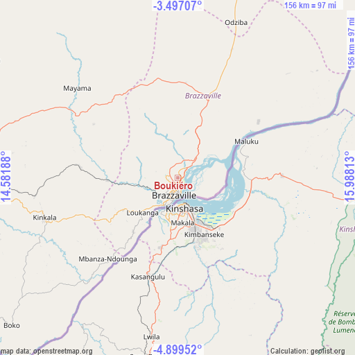
Boukiéro GPS coordinates[2]
4° 11' 54.996" South, 15° 17' 6" East
| Map corner | latitude | longitude |
|---|---|---|
| Upper-left | -3.49707°, | 14.58188° |
| Center: | -4.19861°, | 15.285° |
| Lower-right: | -4.89952°, | 15.98813° |
| Map W x H: | 155.9×155.9 km | = 96.9×96.9mi |
| max Lat: | 1.64806° ⇑68.4% North |
| Boukiéro: | -4.19861° |
| min Lat: | ⇓31.6% South -4.77609° |
| min Long | Boukiéro | max Long |
| 11.8125° | 15.285° | 18.05981° |
| W 73.7%⇐ | ⇒26.3% E |
Elevation
Elevation of Boukiéro is 455 m = 1493 ft, and this is 136 m = 446 ft above average elevation for this country.
| Max E: |
790 m = 2592 ft | 10.5% |
| Boukiéro | 455 m 1493 ft | |
| Avg. | 319 m = 1047 ft | |
Min E: |
7 m = 23 ft | 89.5% |
See also: Republic of the Congo elevation on elevation.city.
Geographical zone
Boukiéro is located in South Torrid zone (between Equator and Tropic of Capricorn). Distance of Equator is 466.8 km =290.1 mi to North.| Distance of | km | miles | from Boukiéro |
|---|---|---|---|
| Equator | 466.8 | 290.1 | to North |
| Tropic Capricorn | 2139.1 | 1329.2 | to South |
| Antarctic Circle | 6934.3 | 4308.8 | to South |
| South Pole | 9540.2 | 5928 | to South |


Nearby cities:
15 places around Boukiéro: (largest is in red/bold)
• Brazzaville
7.5 km =4.7 mi,  181°
181°
• Djambala
193.1 km =120 mi,  342°
342°
• Dolisie
290.4 km =180.4 mi,  270°
270°
• Ewo
373.4 km =232 mi,  352°
352°
• Gamboma
266.1 km =165.3 mi,  13°
13°
• Kayes
221.7 km =137.8 mi, 269°
• Kinkala
60.5 km =37.6 mi,  252°
252°
• Loandjili
384.9 km =239.2 mi,  260°
260°
• Loango
388.2 km =241.2 mi, 262°
• Madingou
192.5 km =119.6 mi, 271°
• Mossendjo
318.3 km =197.8 mi,  295°
295°
• Nkayi
221.7 km =137.8 mi, 270°
• Owando
418.9 km =260.3 mi, 9°
• Pointe-Noire
384.7 km =239 mi, 260°
• Sibiti
222.2 km =138.1 mi,  284°
284°
Sources, notices
• [Note1] Compared only with cities in Republic of the Congo existing in our database
• [Src1] Map data: © OpenStreetMap contributors (CC-BY-SA)
• [Src2] Other city data from geonames.org with taken over terms of usage.
• [Src3] Geographical zone / Annual Mean Temperature by Robert A. Rohde @ Wikipedia
