Welschenrohr geodata
Welschenrohr (Solothurn) is a populated place; located in Switzerland in Europe/Zurich (GMT+2) time zone. With population of 1,179 people, there are 1215 cities with bigger population in this country. Compared to other cities in Switzerland, 56% of cities are located further ↓South; 74.8% of cities are located further →East and 81.2% of cities have lower elevation than Welschenrohr. Note1


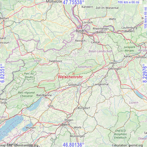
Welschenrohr GPS coordinates[2]
47° 16' 49.872" North, 7° 31' 35.904" East
| Map corner | latitude | longitude |
|---|---|---|
| Upper-left | 47.75538°, | 6.82351° |
| Center: | 47.28052°, | 7.52664° |
| Lower-right: | 46.80136°, | 8.22976° |
| Map W x H: | 106.1×106.1 km | = 65.9×65.9mi |
| max Lat: | 47.76737° ⇑44% North |
| Welschenrohr: | 47.28052° |
| min Lat: | ⇓56% South 45.83203° |
| min Long | Welschenrohr | max Long |
| 5.97153° | 7.52664° | 10.44624° |
| W 25.2%⇐ | ⇒74.8% E |
Elevation
Elevation of Welschenrohr is 678 m = 2224 ft, and this is 119.8 m = 393 ft above average elevation for this country.
| Max E: |
1845 m = 6053 ft | 18.8% |
| Welschenrohr | 678 m 2224 ft | |
| Avg. | 558.2 m = 1831 ft | |
Min E: |
197 m = 646 ft | 81.2% |
See also: Switzerland elevation on elevation.city.
Geographical zone
Welschenrohr is located in North temperate zone (between Tropic of Cancer and the Arctic Circle). Distance of this North polar circle is 2144.1 km =1332.3 mi to North.| Distance of | km | miles | from Welschenrohr |
|---|---|---|---|
| North Pole | 4750 | 2951.5 | to North |
| Arctic Circle | 2144.1 | 1332.3 | to North |
| Tropic Cancer | 2651.2 | 1647.4 | to South |
| Equator | 5257.1 | 3266.6 | to South |


Nearby cities:
15 places around Welschenrohr: (largest is in red/bold)
• Aedermannsdorf
6.8 km =4.2 mi,  67°
67°
• Attiswil
7.6 km =4.7 mi,  119°
119°
• Crémines
6.5 km =4 mi,  272°
272°
• Deitingen
10.1 km =6.3 mi,  136°
136°
• Derendingen
10.2 km =6.3 mi,  152°
152°
• Herbetswil
5.3 km =3.3 mi, 70°
• Langendorf
6.8 km =4.2 mi,  187°
187°
• Luterbach
8.6 km =5.3 mi, 149°
• Matzendorf
8.1 km =5 mi, 71°
• Mervelier
7.3 km =4.5 mi,  343°
343°
• Riedholz
6.3 km =3.9 mi, 149°
• Selzach
10 km =6.2 mi,  212°
212°
• Solothurn
8.1 km =5 mi,  174°
174°
• Wiedlisbach
9.6 km =6 mi,  109°
109°
• Zuchwil
9.3 km =5.8 mi,  161°
161°
Sources, notices
• [Note1] Compared only with cities in Switzerland existing in our database
• [Src1] Map data: © OpenStreetMap contributors (CC-BY-SA)
• [Src2] Other city data from geonames.org with taken over terms of usage.
• [Src3] Geographical zone / Annual Mean Temperature by Robert A. Rohde @ Wikipedia
