Schüpfheim geodata
Schüpfheim (Lucerne) is a seat of a second-order administrative division; located in Switzerland in Europe/Zurich (GMT+2) time zone. With population of 3,723 people, there are 478 cities with bigger population in this country. Compared to other cities in Switzerland, 66.8% of cities are located further ↑North; 60% of cities are located further →East and 84.2% of cities have lower elevation than Schüpfheim. Note1


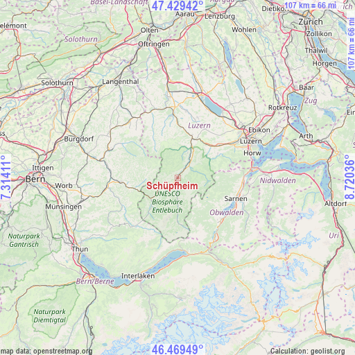
Schüpfheim GPS coordinates[2]
46° 57' 5.796" North, 8° 1' 2.028" East
| Map corner | latitude | longitude |
|---|---|---|
| Upper-left | 47.42942°, | 7.31411° |
| Center: | 46.95161°, | 8.01723° |
| Lower-right: | 46.46949°, | 8.72036° |
| Map W x H: | 106.7×106.7 km | = 66.3×66.3mi |
| max Lat: | 47.76737° ⇑66.8% North |
| Schüpfheim: | 46.95161° |
| min Lat: | ⇓33.2% South 45.83203° |
| min Long | Schüpfheim | max Long |
| 5.97153° | 8.01723° | 10.44624° |
| W 40%⇐ | ⇒60% E |
Elevation
Elevation of Schüpfheim is 723 m = 2372 ft, and this is 164.8 m = 541 ft above average elevation for this country.
| Max E: |
1845 m = 6053 ft | 15.8% |
| Schüpfheim | 723 m 2372 ft | |
| Avg. | 558.2 m = 1831 ft | |
Min E: |
197 m = 646 ft | 84.2% |
See also: Switzerland elevation on elevation.city.
Geographical zone
Schüpfheim is located in North temperate zone (between Tropic of Cancer and the Arctic Circle). Distance of this North polar circle is 2180.6 km =1355 mi to North.| Distance of | km | miles | from Schüpfheim |
|---|---|---|---|
| North Pole | 4786.5 | 2974.2 | to North |
| Arctic Circle | 2180.6 | 1355 | to North |
| Tropic Cancer | 2614.6 | 1624.6 | to South |
| Equator | 5220.5 | 3243.9 | to South |


Nearby cities:
15 places around Schüpfheim: (largest is in red/bold)
• Doppleschwand
8 km =5 mi,  21°
21°
• Entlebuch
6 km =3.7 mi,  35°
35°
• Escholzmatt
7.6 km =4.7 mi,  236°
236°
• Flühli
7.5 km =4.7 mi,  180°
180°
• Hasle
4 km =2.5 mi, 43°
• Langnau
17.5 km =10.9 mi,  265°
265°
• Luthern
14 km =8.7 mi,  327°
327°
• Malters
15.6 km =9.7 mi,  52°
52°
• Menznau
14.8 km =9.2 mi,  6°
6°
• Ruswil
16.9 km =10.5 mi,  29°
29°
• Schwarzenberg
13.9 km =8.6 mi,  58°
58°
• Trub
10.5 km =6.5 mi,  263°
263°
• Trubschachen
13.5 km =8.4 mi, 255°
• Werthenstein
13.2 km =8.2 mi, 28°
• Wolhusen
12.8 km =8 mi, 19°
Sources, notices
• [Note1] Compared only with cities in Switzerland existing in our database
• [Src1] Map data: © OpenStreetMap contributors (CC-BY-SA)
• [Src2] Other city data from geonames.org with taken over terms of usage.
• [Src3] Geographical zone / Annual Mean Temperature by Robert A. Rohde @ Wikipedia
