Flühli geodata
Flühli (Lucerne) is a populated place; located in Switzerland in Europe/Zurich (GMT+2) time zone. With population of 1,937 people, there are 858 cities with bigger population in this country. Compared to other cities in Switzerland, 70.3% of cities are located further ↑North; 60% of cities are located further →East and 92.2% of cities have lower elevation than Flühli. Note1


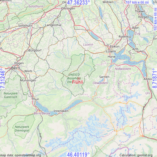
Flühli GPS coordinates[2]
46° 53' 2.076" North, 8° 0' 56.088" East
| Map corner | latitude | longitude |
|---|---|---|
| Upper-left | 47.36233°, | 7.31246° |
| Center: | 46.88391°, | 8.01558° |
| Lower-right: | 46.40119°, | 8.71871° |
| Map W x H: | 106.9×106.9 km | = 66.4×66.4mi |
| max Lat: | 47.76737° ⇑70.3% North |
| Flühli: | 46.88391° |
| min Lat: | ⇓29.7% South 45.83203° |
| min Long | Flühli | max Long |
| 5.97153° | 8.01558° | 10.44624° |
| W 40%⇐ | ⇒60% E |
Elevation
Elevation of Flühli is 886 m = 2907 ft, and this is 327.8 m = 1075 ft above average elevation for this country.
| Max E: |
1845 m = 6053 ft | 7.8% |
| Flühli | 886 m 2907 ft | |
| Avg. | 558.2 m = 1831 ft | |
Min E: |
197 m = 646 ft | 92.2% |
See also: Switzerland elevation on elevation.city.
Geographical zone
Flühli is located in North temperate zone (between Tropic of Cancer and the Arctic Circle). Distance of this North polar circle is 2188.2 km =1359.7 mi to North.| Distance of | km | miles | from Flühli |
|---|---|---|---|
| North Pole | 4794.1 | 2978.9 | to North |
| Arctic Circle | 2188.2 | 1359.7 | to North |
| Tropic Cancer | 2607.1 | 1620 | to South |
| Equator | 5213 | 3239.2 | to South |


Nearby cities:
15 places around Flühli: (largest is in red/bold)
• Brienz
14.5 km =9 mi,  173°
173°
• Brienzwiler
16.2 km =10.1 mi,  156°
156°
• Doppleschwand
15.2 km =9.4 mi,  11°
11°
• Eggiwil
16.7 km =10.4 mi,  266°
266°
• Entlebuch
12.9 km =8 mi,  16°
16°
• Escholzmatt
7 km =4.3 mi,  298°
298°
• Giswil
13.8 km =8.6 mi,  114°
114°
• Hasle
10.8 km =6.7 mi, 15°
• Lungern
15.5 km =9.6 mi,  134°
134°
• Sachseln
16.7 km =10.4 mi,  96°
96°
• Sarnen
17.5 km =10.9 mi,  85°
85°
• Schangnau
13.4 km =8.3 mi,  242°
242°
• Schüpfheim
7.5 km =4.7 mi,  0°
0°
• Trub
12.1 km =7.5 mi, 301°
• Trubschachen
13.6 km =8.5 mi,  288°
288°
Sources, notices
• [Note1] Compared only with cities in Switzerland existing in our database
• [Src1] Map data: © OpenStreetMap contributors (CC-BY-SA)
• [Src2] Other city data from geonames.org with taken over terms of usage.
• [Src3] Geographical zone / Annual Mean Temperature by Robert A. Rohde @ Wikipedia
