Lungern geodata
Lungern (Obwalden) is a populated place; located in Switzerland in Europe/Zurich (GMT+2) time zone. With population of 1,921 people, there are 866 cities with bigger population in this country. Compared to other cities in Switzerland, 75.3% of cities are located further ↑North; 56.6% of cities are located further →East and 83.5% of cities have lower elevation than Lungern. Note1


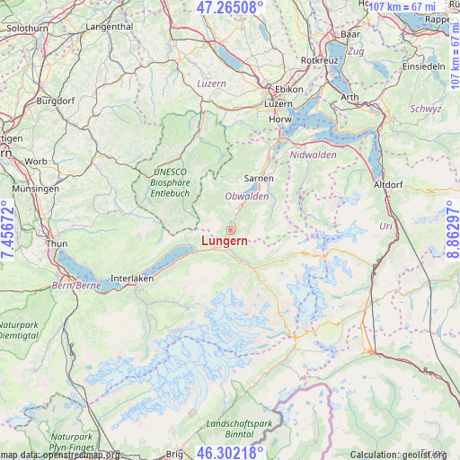
Lungern GPS coordinates[2]
46° 47' 8.808" North, 8° 9' 35.424" East
| Map corner | latitude | longitude |
|---|---|---|
| Upper-left | 47.26508°, | 7.45672° |
| Center: | 46.78578°, | 8.15984° |
| Lower-right: | 46.30218°, | 8.86297° |
| Map W x H: | 107.1×107.1 km | = 66.5×66.5mi |
| max Lat: | 47.76737° ⇑75.3% North |
| Lungern: | 46.78578° |
| min Lat: | ⇓24.7% South 45.83203° |
| min Long | Lungern | max Long |
| 5.97153° | 8.15984° | 10.44624° |
| W 43.4%⇐ | ⇒56.6% E |
Elevation
Elevation of Lungern is 716 m = 2349 ft, and this is 157.8 m = 518 ft above average elevation for this country.
| Max E: |
1845 m = 6053 ft | 16.5% |
| Lungern | 716 m 2349 ft | |
| Avg. | 558.2 m = 1831 ft | |
Min E: |
197 m = 646 ft | 83.5% |
See also: Switzerland elevation on elevation.city.
Geographical zone
Lungern is located in North temperate zone (between Tropic of Cancer and the Arctic Circle). Distance of this North polar circle is 2199.1 km =1366.5 mi to North.| Distance of | km | miles | from Lungern |
|---|---|---|---|
| North Pole | 4805 | 2985.7 | to North |
| Arctic Circle | 2199.1 | 1366.5 | to North |
| Tropic Cancer | 2596.2 | 1613.2 | to South |
| Equator | 5202.1 | 3232.4 | to South |


Nearby cities:
15 places around Lungern: (largest is in red/bold)
• Alpnach
19.4 km =12.1 mi,  26°
26°
• Brienz
9.9 km =6.2 mi,  249°
249°
• Brienzwiler
5.9 km =3.7 mi,  228°
228°
• Engelberg
18.8 km =11.7 mi,  77°
77°
• Escholzmatt
22.3 km =13.9 mi,  309°
309°
• Flühli
15.5 km =9.6 mi, 314°
• Giswil
5.5 km =3.4 mi,  16°
16°
• Grindelwald
20.3 km =12.6 mi,  207°
207°
• Kerns
15.5 km =9.6 mi, 34°
• Meiringen
6.9 km =4.3 mi,  162°
162°
• Ringgenberg
22.3 km =13.9 mi, 245°
• Sachseln
10.6 km =6.6 mi, 31°
• Sarnen
13.9 km =8.6 mi, 27°
• Schüpfheim
21.4 km =13.3 mi,  329°
329°
• Wolfenschiessen
22.1 km =13.7 mi,  53°
53°
Sources, notices
• [Note1] Compared only with cities in Switzerland existing in our database
• [Src1] Map data: © OpenStreetMap contributors (CC-BY-SA)
• [Src2] Other city data from geonames.org with taken over terms of usage.
• [Src3] Geographical zone / Annual Mean Temperature by Robert A. Rohde @ Wikipedia
