Sachseln geodata
Sachseln (Obwalden) is a populated place; located in Switzerland in Europe/Zurich (GMT+2) time zone. With population of 4,511 people, there are 383 cities with bigger population in this country. Compared to other cities in Switzerland, 71.2% of cities are located further ↑North; 54.7% of cities are located further →East and 50.3% of cities have higher elevation than Sachseln. Note1


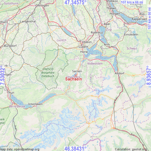
Sachseln GPS coordinates[2]
46° 52' 1.848" North, 8° 14' 0.384" East
| Map corner | latitude | longitude |
|---|---|---|
| Upper-left | 47.34575°, | 7.53032° |
| Center: | 46.86718°, | 8.23344° |
| Lower-right: | 46.38431°, | 8.93657° |
| Map W x H: | 106.9×106.9 km | = 66.4×66.4mi |
| max Lat: | 47.76737° ⇑71.2% North |
| Sachseln: | 46.86718° |
| min Lat: | ⇓28.8% South 45.83203° |
| min Long | Sachseln | max Long |
| 5.97153° | 8.23344° | 10.44624° |
| W 45.3%⇐ | ⇒54.7% E |
Elevation
Elevation of Sachseln is 477 m = 1565 ft, and this is 81.2 m = 266 ft below average elevation for this country.
| Max E: |
1845 m = 6053 ft | 50.3% |
| Avg. | 558.2 m = 1831 ft | |
| Sachseln | 477 m = 1565 ft | |
Min E: |
197 m = 646 ft | 49.7% |
See also: Switzerland elevation on elevation.city.
Geographical zone
Sachseln is located in North temperate zone (between Tropic of Cancer and the Arctic Circle). Distance of this North polar circle is 2190 km =1360.8 mi to North.| Distance of | km | miles | from Sachseln |
|---|---|---|---|
| North Pole | 4795.9 | 2980 | to North |
| Arctic Circle | 2190 | 1360.8 | to North |
| Tropic Cancer | 2605.2 | 1618.8 | to South |
| Equator | 5211.1 | 3238 | to South |


Nearby cities:
15 places around Sachseln: (largest is in red/bold)
• Alpnach
8.8 km =5.5 mi,  19°
19°
• Brienzwiler
16.4 km =10.2 mi,  217°
217°
• Dallenwil
13.3 km =8.3 mi,  61°
61°
• Engelberg
13.8 km =8.6 mi,  111°
111°
• Flühli
16.7 km =10.4 mi,  276°
276°
• Giswil
5.5 km =3.4 mi,  226°
226°
• Hergiswil
14.2 km =8.8 mi, 23°
• Kerns
4.9 km =3 mi,  39°
39°
• Lungern
10.6 km =6.6 mi,  211°
211°
• Meiringen
16 km =9.9 mi,  192°
192°
• Sarnen
3.3 km =2.1 mi, 15°
• Schwarzenberg
17.3 km =10.7 mi,  344°
344°
• Stans
14.3 km =8.9 mi, 44°
• Stansstad
14.4 km =8.9 mi,  32°
32°
• Wolfenschiessen
12.9 km =8 mi,  71°
71°
Sources, notices
• [Note1] Compared only with cities in Switzerland existing in our database
• [Src1] Map data: © OpenStreetMap contributors (CC-BY-SA)
• [Src2] Other city data from geonames.org with taken over terms of usage.
• [Src3] Geographical zone / Annual Mean Temperature by Robert A. Rohde @ Wikipedia
