Brienzwiler geodata
Brienzwiler (Bern) is a populated place; located in Switzerland in Europe/Zurich (GMT+2) time zone. With population of 580 people, there are 1713 cities with bigger population in this country. Compared to other cities in Switzerland, 76.6% of cities are located further ↑North; 57.8% of cities are located further →East and 81.1% of cities have lower elevation than Brienzwiler. Note1
Administrative division(s):
- Level 1: Bern
- Level 2: Interlaken-Oberhasli District
- Level 3: Brienzwiler


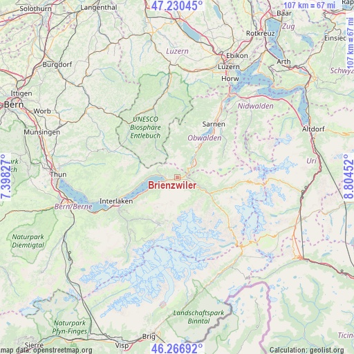
Brienzwiler GPS coordinates[2]
46° 45' 3.024" North, 8° 6' 5.004" East
| Map corner | latitude | longitude |
|---|---|---|
| Upper-left | 47.23045°, | 7.39827° |
| Center: | 46.75084°, | 8.10139° |
| Lower-right: | 46.26692°, | 8.80452° |
| Map W x H: | 107.1×107.1 km | = 66.5×66.5mi |
| max Lat: | 47.76737° ⇑76.6% North |
| Brienzwiler: | 46.75084° |
| min Lat: | ⇓23.4% South 45.83203° |
| min Long | Brienzwiler | max Long |
| 5.97153° | 8.10139° | 10.44624° |
| W 42.2%⇐ | ⇒57.8% E |
Elevation
Elevation of Brienzwiler is 677 m = 2221 ft, and this is 118.8 m = 390 ft above average elevation for this country.
| Max E: |
1845 m = 6053 ft | 18.9% |
| Brienzwiler | 677 m 2221 ft | |
| Avg. | 558.2 m = 1831 ft | |
Min E: |
197 m = 646 ft | 81.1% |
See also: Switzerland elevation on elevation.city.
Geographical zone
Brienzwiler is located in North temperate zone (between Tropic of Cancer and the Arctic Circle). Distance of this North polar circle is 2203 km =1368.9 mi to North.| Distance of | km | miles | from Brienzwiler |
|---|---|---|---|
| North Pole | 4808.9 | 2988.1 | to North |
| Arctic Circle | 2203 | 1368.9 | to North |
| Tropic Cancer | 2592.3 | 1610.8 | to South |
| Equator | 5198.2 | 3230 | to South |


Nearby cities:
15 places around Brienzwiler: (largest is in red/bold)
• Brienz
4.8 km =3 mi,  274°
274°
• Bönigen
17.3 km =10.7 mi,  245°
245°
• Flühli
16.2 km =10.1 mi,  336°
336°
• Giswil
11 km =6.8 mi,  33°
33°
• Grindelwald
15 km =9.3 mi,  199°
199°
• Gsteig
19.9 km =12.4 mi,  241°
241°
• Habkern
18.4 km =11.4 mi,  261°
261°
• Interlaken
19.4 km =12.1 mi, 247°
• Lungern
5.9 km =3.7 mi,  48°
48°
• Matten
19.5 km =12.1 mi, 245°
• Meiringen
7.1 km =4.4 mi,  111°
111°
• Ringgenberg
16.7 km =10.4 mi, 250°
• Sachseln
16.4 km =10.2 mi,  37°
37°
• Sarnen
19.5 km =12.1 mi, 34°
• Schangnau
20.3 km =12.6 mi,  294°
294°
Sources, notices
• [Note1] Compared only with cities in Switzerland existing in our database
• [Src1] Map data: © OpenStreetMap contributors (CC-BY-SA)
• [Src2] Other city data from geonames.org with taken over terms of usage.
• [Src3] Geographical zone / Annual Mean Temperature by Robert A. Rohde @ Wikipedia
