Eschenz geodata
Eschenz (Thurgau) is a populated place; located in Switzerland in Europe/Zurich (GMT+2) time zone. With population of 1,508 people, there are 1031 cities with bigger population in this country. Compared to other cities in Switzerland, 98.3% of cities are located further ↓South; 84.3% of cities are located further ←West and 86.6% of cities have higher elevation than Eschenz. Note1


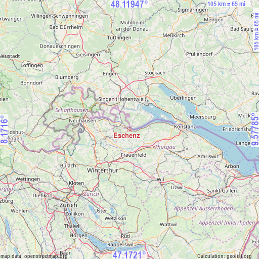
Eschenz GPS coordinates[2]
47° 38' 52.548" North, 8° 52' 28.992" East
| Map corner | latitude | longitude |
|---|---|---|
| Upper-left | 48.11947°, | 8.1716° |
| Center: | 47.64793°, | 8.87472° |
| Lower-right: | 47.1721°, | 9.57785° |
| Map W x H: | 105.3×105.3 km | = 65.4×65.4mi |
| max Lat: | 47.76737° ⇑1.7% North |
| Eschenz: | 47.64793° |
| min Lat: | ⇓98.3% South 45.83203° |
| min Long | Eschenz | max Long |
| 5.97153° | 8.87472° | 10.44624° |
| W 84.3%⇐ | ⇒15.7% E |
Elevation
Elevation of Eschenz is 406 m = 1332 ft, and this is 152.2 m = 499 ft below average elevation for this country.
| Max E: |
1845 m = 6053 ft | 86.6% |
| Avg. | 558.2 m = 1831 ft | |
| Eschenz | 406 m = 1332 ft | |
Min E: |
197 m = 646 ft | 13.4% |
See also: Switzerland elevation on elevation.city.
Geographical zone
Eschenz is located in North temperate zone (between Tropic of Cancer and the Arctic Circle). Distance of this North polar circle is 2103.2 km =1306.9 mi to North.| Distance of | km | miles | from Eschenz |
|---|---|---|---|
| North Pole | 4709.1 | 2926.1 | to North |
| Arctic Circle | 2103.2 | 1306.9 | to North |
| Tropic Cancer | 2692 | 1672.7 | to South |
| Equator | 5298 | 3292 | to South |


Nearby cities:
15 places around Eschenz: (largest is in red/bold)
• Diessenhofen
10.4 km =6.5 mi,  296°
296°
• Frauenfeld
10.2 km =6.3 mi,  169°
169°
• Herdern
5.7 km =3.5 mi,  151°
151°
• Homburg
10.1 km =6.3 mi,  98°
98°
• Hüttwilen
4.6 km =2.9 mi,  181°
181°
• Mammern
3 km =1.9 mi,  93°
93°
• Müllheim
10.9 km =6.8 mi,  117°
117°
• Oberneuforn
9.4 km =5.8 mi,  239°
239°
• Oberstammheim
5.9 km =3.7 mi,  252°
252°
• Pfyn
8.2 km =5.1 mi,  133°
133°
• Ramsen
8.3 km =5.2 mi,  323°
323°
• Steckborn
8.4 km =5.2 mi,  75°
75°
• Stein am Rhein
1.7 km =1.1 mi, 318°
• Unterstammheim
6.4 km =4 mi,  261°
261°
• Wagenhausen
2.4 km =1.5 mi, 303°
Sources, notices
• [Note1] Compared only with cities in Switzerland existing in our database
• [Src1] Map data: © OpenStreetMap contributors (CC-BY-SA)
• [Src2] Other city data from geonames.org with taken over terms of usage.
• [Src3] Geographical zone / Annual Mean Temperature by Robert A. Rohde @ Wikipedia
