Wagenhausen geodata
Wagenhausen (Thurgau) is a populated place; located in Switzerland in Europe/Zurich (GMT+2) time zone. With population of 1,524 people, there are 1022 cities with bigger population in this country. Compared to other cities in Switzerland, 98.6% of cities are located further ↓South; 82.8% of cities are located further ←West and 86.8% of cities have higher elevation than Wagenhausen. Note1


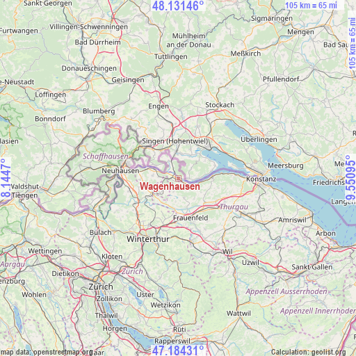
Wagenhausen GPS coordinates[2]
47° 39' 36.108" North, 8° 50' 52.152" East
| Map corner | latitude | longitude |
|---|---|---|
| Upper-left | 48.13146°, | 8.1447° |
| Center: | 47.66003°, | 8.84782° |
| Lower-right: | 47.18431°, | 9.55095° |
| Map W x H: | 105.3×105.3 km | = 65.4×65.4mi |
| max Lat: | 47.76737° ⇑1.4% North |
| Wagenhausen: | 47.66003° |
| min Lat: | ⇓98.6% South 45.83203° |
| min Long | Wagenhausen | max Long |
| 5.97153° | 8.84782° | 10.44624° |
| W 82.8%⇐ | ⇒17.2% E |
Elevation
Elevation of Wagenhausen is 405 m = 1329 ft, and this is 153.2 m = 503 ft below average elevation for this country.
| Max E: |
1845 m = 6053 ft | 86.8% |
| Avg. | 558.2 m = 1831 ft | |
| Wagenhausen | 405 m = 1329 ft | |
Min E: |
197 m = 646 ft | 13.2% |
See also: Switzerland elevation on elevation.city.
Geographical zone
Wagenhausen is located in North temperate zone (between Tropic of Cancer and the Arctic Circle). Distance of this North polar circle is 2101.9 km =1306.1 mi to North.| Distance of | km | miles | from Wagenhausen |
|---|---|---|---|
| North Pole | 4707.8 | 2925.3 | to North |
| Arctic Circle | 2101.9 | 1306.1 | to North |
| Tropic Cancer | 2693.4 | 1673.6 | to South |
| Equator | 5299.3 | 3292.8 | to South |


Nearby cities:
15 places around Wagenhausen: (largest is in red/bold)
• Diessenhofen
8 km =5 mi,  293°
293°
• Dörflingen
10.7 km =6.6 mi,  298°
298°
• Eschenz
2.4 km =1.5 mi,  123°
123°
• Frauenfeld
12 km =7.5 mi,  161°
161°
• Herdern
7.9 km =4.9 mi,  143°
143°
• Hüttwilen
6.2 km =3.9 mi, 162°
• Mammern
5.3 km =3.3 mi,  106°
106°
• Oberneuforn
8.6 km =5.3 mi,  224°
224°
• Oberstammheim
4.7 km =2.9 mi,  229°
229°
• Ossingen
10.5 km =6.5 mi,  239°
239°
• Pfyn
10.6 km =6.6 mi,  131°
131°
• Ramsen
6.1 km =3.8 mi,  331°
331°
• Steckborn
10.2 km =6.3 mi,  85°
85°
• Stein am Rhein
0.9 km =0.6 mi,  95°
95°
• Unterstammheim
4.9 km =3 mi, 241°
Sources, notices
• [Note1] Compared only with cities in Switzerland existing in our database
• [Src1] Map data: © OpenStreetMap contributors (CC-BY-SA)
• [Src2] Other city data from geonames.org with taken over terms of usage.
• [Src3] Geographical zone / Annual Mean Temperature by Robert A. Rohde @ Wikipedia
