Holderbank geodata
Holderbank (Solothurn) is a populated place; located in Switzerland in Europe/Zurich (GMT+2) time zone. With population of 691 people, there are 1608 cities with bigger population in this country. Compared to other cities in Switzerland, 62.6% of cities are located further ↓South; 66.9% of cities are located further →East and 78.9% of cities have lower elevation than Holderbank. Note1


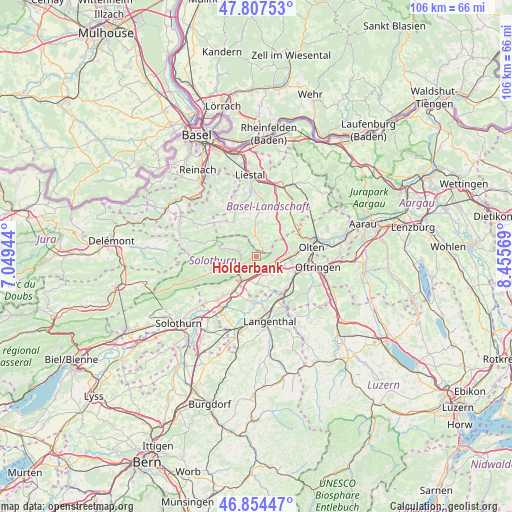
Holderbank GPS coordinates[2]
47° 19' 59.34" North, 7° 45' 9.252" East
| Map corner | latitude | longitude |
|---|---|---|
| Upper-left | 47.80753°, | 7.04944° |
| Center: | 47.33315°, | 7.75257° |
| Lower-right: | 46.85447°, | 8.45569° |
| Map W x H: | 106×106 km | = 65.9×65.9mi |
| max Lat: | 47.76737° ⇑37.4% North |
| Holderbank: | 47.33315° |
| min Lat: | ⇓62.6% South 45.83203° |
| min Long | Holderbank | max Long |
| 5.97153° | 7.75257° | 10.44624° |
| W 33.1%⇐ | ⇒66.9% E |
Elevation
Elevation of Holderbank is 648 m = 2126 ft, and this is 89.8 m = 295 ft above average elevation for this country.
| Max E: |
1845 m = 6053 ft | 21.1% |
| Holderbank | 648 m 2126 ft | |
| Avg. | 558.2 m = 1831 ft | |
Min E: |
197 m = 646 ft | 78.9% |
See also: Switzerland elevation on elevation.city.
Geographical zone
Holderbank is located in North temperate zone (between Tropic of Cancer and the Arctic Circle). Distance of this North polar circle is 2138.2 km =1328.6 mi to North.| Distance of | km | miles | from Holderbank |
|---|---|---|---|
| North Pole | 4744.1 | 2947.8 | to North |
| Arctic Circle | 2138.2 | 1328.6 | to North |
| Tropic Cancer | 2657 | 1651 | to South |
| Equator | 5263 | 3270.3 | to South |


Nearby cities:
15 places around Holderbank: (largest is in red/bold)
• Balsthal
4.9 km =3 mi,  247°
247°
• Egerkingen
2.8 km =1.7 mi,  122°
122°
• Gunzgen
6.3 km =3.9 mi,  110°
110°
• Hägendorf
6.7 km =4.2 mi,  88°
88°
• Langenbruck
2.1 km =1.3 mi,  33°
33°
• Laupersdorf
7.7 km =4.8 mi, 252°
• Niederbipp
8.1 km =5 mi,  212°
212°
• Niederbuchsiten
4.3 km =2.7 mi,  160°
160°
• Oberbuchsiten
2.5 km =1.6 mi,  151°
151°
• Oberdorf
6.7 km =4.2 mi,  359°
359°
• Oensingen
5.8 km =3.6 mi, 208°
• Reigoldswil
8.8 km =5.5 mi,  325°
325°
• Waldenburg
5.6 km =3.5 mi, 358°
• Wangen
8.9 km =5.5 mi,  82°
82°
• Wolfwil
7.9 km =4.9 mi, 155°
Sources, notices
• [Note1] Compared only with cities in Switzerland existing in our database
• [Src1] Map data: © OpenStreetMap contributors (CC-BY-SA)
• [Src2] Other city data from geonames.org with taken over terms of usage.
• [Src3] Geographical zone / Annual Mean Temperature by Robert A. Rohde @ Wikipedia
